

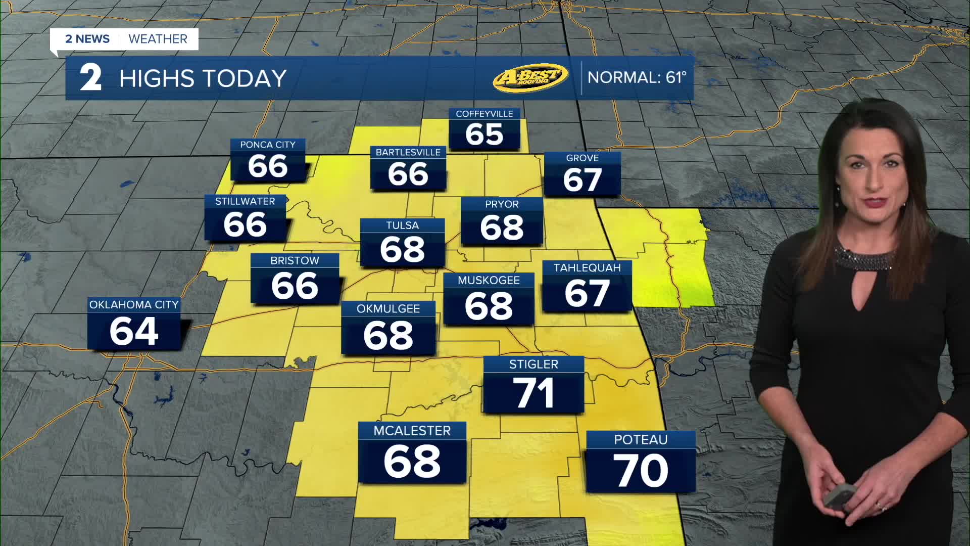


TULSA, OKLA — Temperatures will start Wednesday in the 30s before clouds decrease and sunshine returns. Afternoon highs will reach the upper 60s to around 70 degrees south of I-40, with breezy south winds gusting over 20 mph at times.
Mild southerly winds will continue pushing temperatures higher through the end of the week. Highs will reach the upper 60s to lower 70s again Thursday before climbing into the lower 70s area wide Friday and Saturday. Expect plenty of sunshine and generally dry weather during this stretch.
The breezy conditions and relatively low humidity could lead to some minor fire weather concerns at times, particularly today and again on Saturday. While conditions will be somewhat favorable for fire spread, widespread critical fire weather conditions are not expected.
Our next cold front is expected to move through late Saturday into early Sunday, bringing a chance for showers and perhaps a few thunderstorms. Rainfall amounts currently look limited, with most locations expected to receive a quarter inch or less.
Behind the front, temperatures will drop noticeably, returning closer to seasonal averages. Highs will settle into the lower 50s Sunday and into early next week, with overnight lows approaching freezing.
Looking ahead to Thanksgiving week, temperatures are expected to remain seasonably cool with increasing cloud cover. Additional rain chances could develop beginning Tuesday as another weather system approaches. For now, no significant winter weather or other high-impact conditions are expected.
 Facebook
 TikTok
 YouTube
 Instagram
 Threads
 X
