

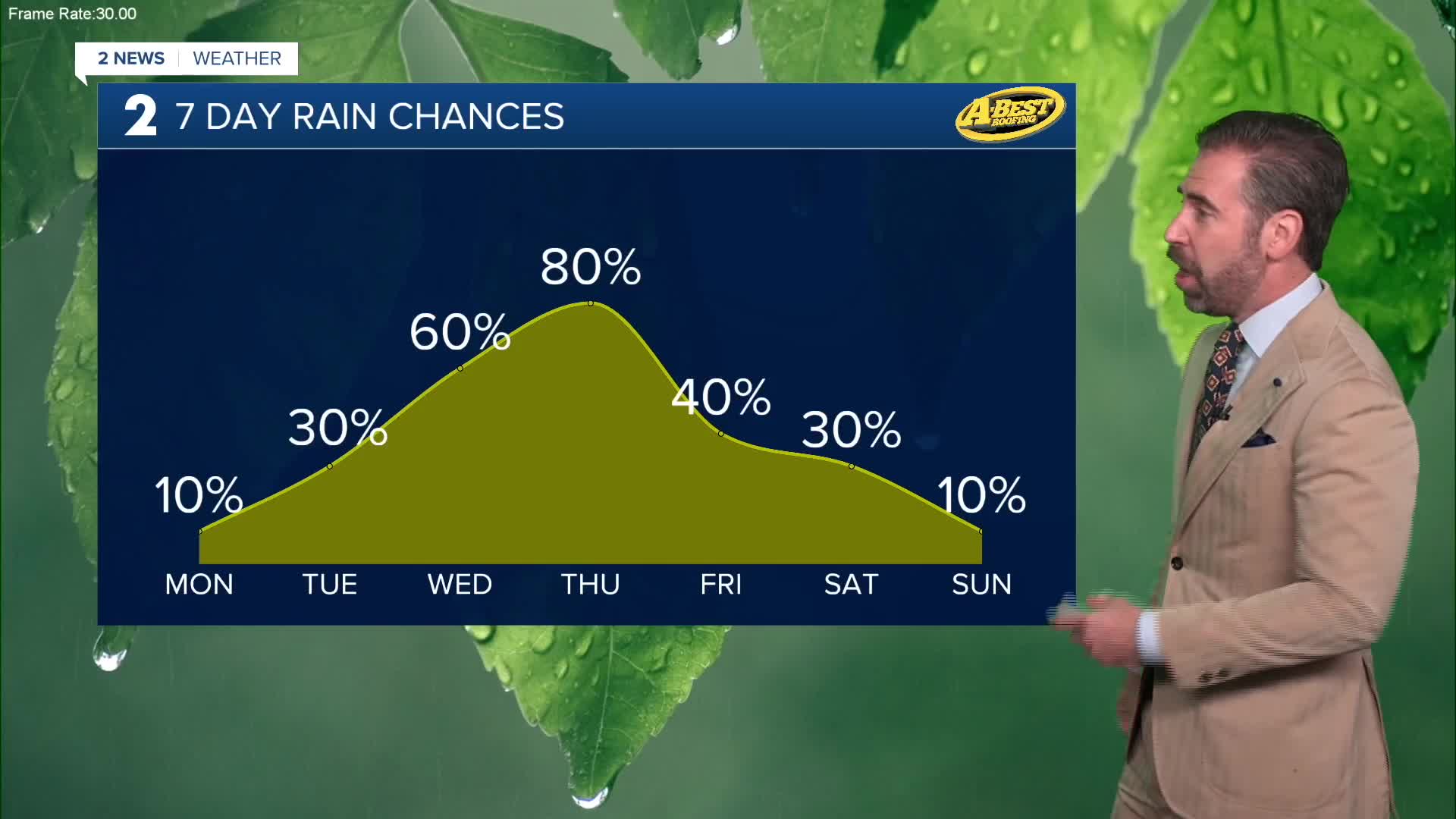


The work week is off to a relatively warm start with temperatures on the rise today into the mid-80s for highs. A few downpours are possible through midday, mainly along and south of I-40. Otherwise, expect partly cloudy and dry conditions with a light southeasterly breeze.
A round of scattered t-showers is possible Tuesday. Temperatures will start off in the 60s and give way to highs in the upper 80s beneath a mix of cloud cover and sunshine. South winds start to pick up ahead of our next slow-moving storm system.
This storm system arriving midweek will be bring the potential for heavy rainfall, a few severe storms and a noticeable cool-down. As of now, the highest chance of rain shows up late Wednesday into Thursday. Before the downpours arrive on Wednesday, expect one more afternoon reaching the mid-80s. Gusty south winds are expected.
The main threat for severe weather will be Wednesday evening with a few pockets of locally damaging wind gusts possible. The heavy rainfall will be the more widespread threat. This could lead to flash flooding into Thursday with continued rainfall and cloudy skies.
Thursday is the kick-off to the Tulsa State Fair. Aside from the likely chance of rain and storms, temperatures will remain mild with highs only in the 70s.
Off-and-on rain may stick around late this week and into the start of the weekend. The unsettled weather and a northerly wind by this point will reinforce the mild air keeping lows in the 60s and highs in the 70s.
 Facebook
  TikTok
  YouTube
 Instagram
 Threads
 X
X