

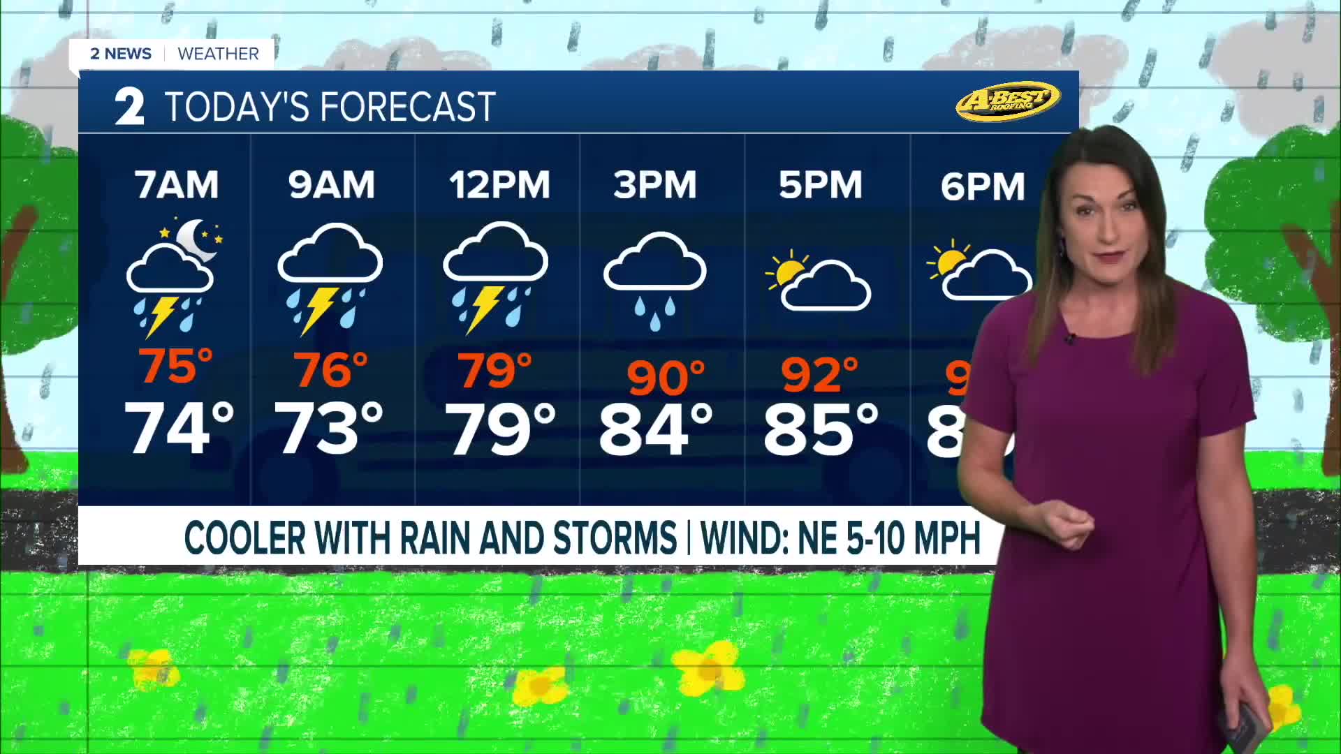


TULSA, OKLA — Storm chances will increase overnight and into Thursday morning as a cold front slowly pushes south through the region. Some areas could see locally heavy rainfall, especially where storms move slowly or repeatedly track over the same locations.
A limited threat for strong to severe wind gusts will exist with the strongest storms Thursday morning and again during the afternoon. The overall severe weather threat is low.
Rain and cloud cover will gradually shift south and east through Thursday. The cooler, wetter weather will keep afternoon temperatures mostly in the 80s, especially north of Interstate 40.
More storms Friday and Saturday
Another round of showers and thunderstorms is possible late Thursday night into Friday morning, particularly across eastern Oklahoma and western Arkansas. With plenty of moisture in the atmosphere, some locations could pick up locally heavy rain.
Friday will be noticeably warmer and more humid as southerly winds return. Highs will climb back into the 90s, with a slight chance for showers and storms, mainly across southeast Oklahoma.
More rain and storms could develop Saturday, especially north of Tulsa. However, much of the weekend will be hot and humid, with highs in the 90s and afternoon heat index values potentially climbing above 100 degrees.
Heat returns next week
The brief cool down won’t last long.
An upper-level ridge is expected to rebuild over the region, bringing well-above-average temperatures back for the weekend and into early next week. Additional heat headlines could become necessary.
The good news: the prolonged stretch of 100-degree temperatures is expected to end after Thursday. Most forecast highs next week will remain in the 90s, although temperatures will depend heavily on where storms and cold fronts develop.
Another front could bring a better chance for rain and cooler temperatures toward the middle of next week, but the timing and strength of that system remain uncertain.
Rain won’t end the drought
Despite several opportunities for rain over the next few days, rainfall totals are not expected to make a significant dent in the widespread drought.
Dry conditions will continue to contribute to worsening fire-weather concerns, especially once the heat and stronger winds return.
For now, Thursday’s rain offers a much-needed break from the heat — but it won’t be the end of the summer-like pattern just yet.
 Facebook
  TikTok
  YouTube
 Instagram
 Threads
 X
X