

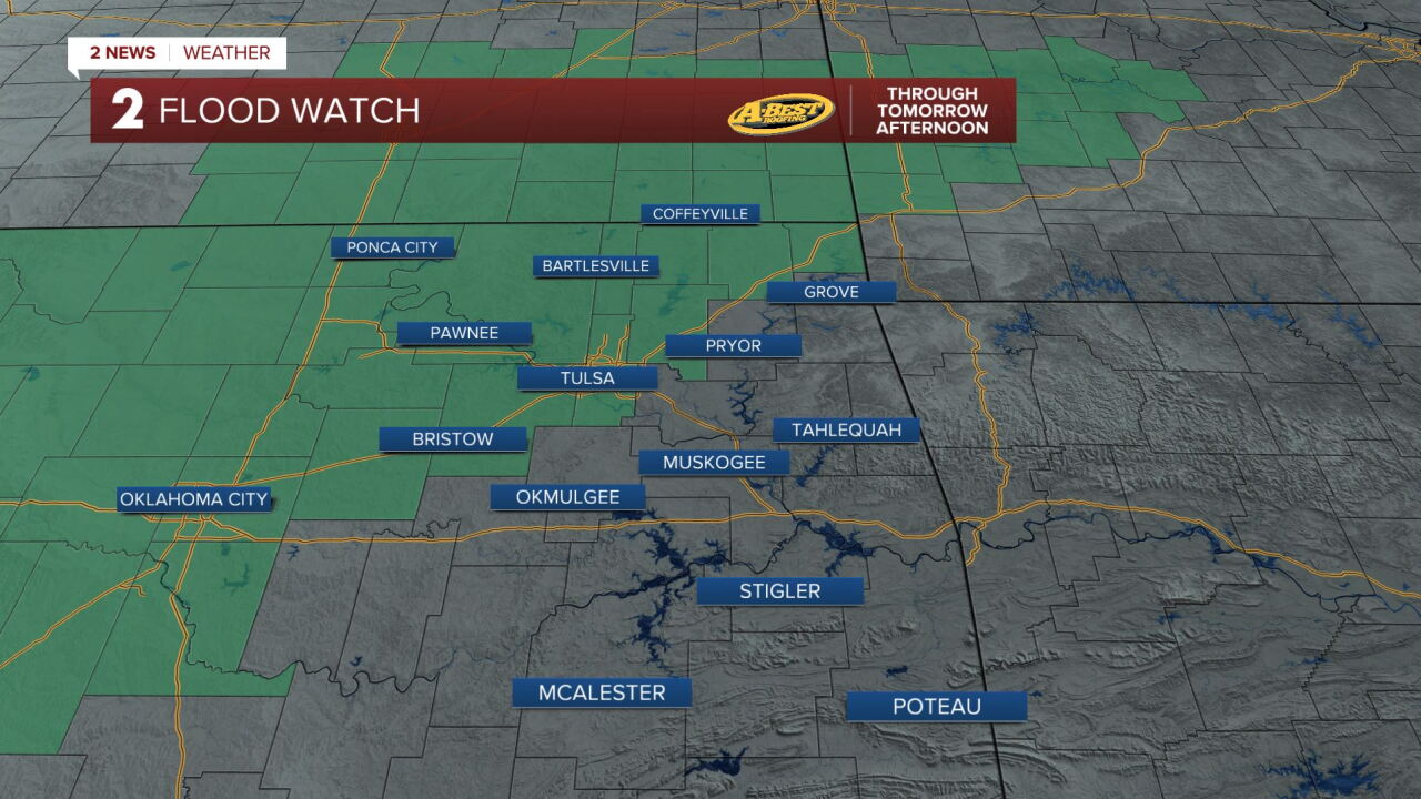


TULSA, OKLA — **FLOOD WATCH IN EFFECT FOR COUNTIES ALONG AND NORTH OF I-44 THROUGH TOMORROW AFTERNOON.**
Rain and storm chances will increase into Wednesday as Gulf moisture surges into eastern Oklahoma. Multiple rounds of showers and thunderstorms are expected through Thursday afternoon, with periods of moderate to locally heavy rainfall.
A Flood Watch is in effect from Wednesday morning through Thursday afternoon for locations along and north of I-44.
Many areas near and north of I-44 could receive 1 to 3 inches of rain, with isolated totals reaching 4 to 5 inches.
Some thunderstorms could produce intense rainfall rates exceeding 2 inches per hour. Flooding and flash flooding are possible, especially in areas where repeated rounds of storms move over the same locations.
A few strong to severe thunderstorms are possible Wednesday, primarily along and north of I-40.
The main concern with any severe storms will be damaging wind gusts exceeding 65 mph. Large hail will also be possible, and a brief tornado cannot be ruled out near a surface boundary.
Storm activity may continue into Wednesday night and Thursday morning. Additional thunderstorms could develop along a passing cold front Thursday afternoon, although the overall severe weather threat is expected to be lower.
Temperatures will remain warm Wednesday and Thursday, with highs in the 70s and lower 80s.
Rain chances will gradually decrease late Thursday into early Friday as a strong cold front moves through Green Country. Gusty north winds will usher in much cooler, drier air, bringing a noticeable end to the summer-like warmth.
By Friday, highs will settle into the 60s, with mostly clear skies and comfortable conditions expected through the weekend. Overnight lows will dip into the upper 30s and 40s Friday and Saturday nights.
A brief chance for additional rain may return late Sunday into early Monday, but much of the weekend is expected to be dry. Temperatures will begin to rebound early next week, with highs returning to the 70s by Tuesday.
 Facebook
  TikTok
  YouTube
 Instagram
 Threads
 X
X