

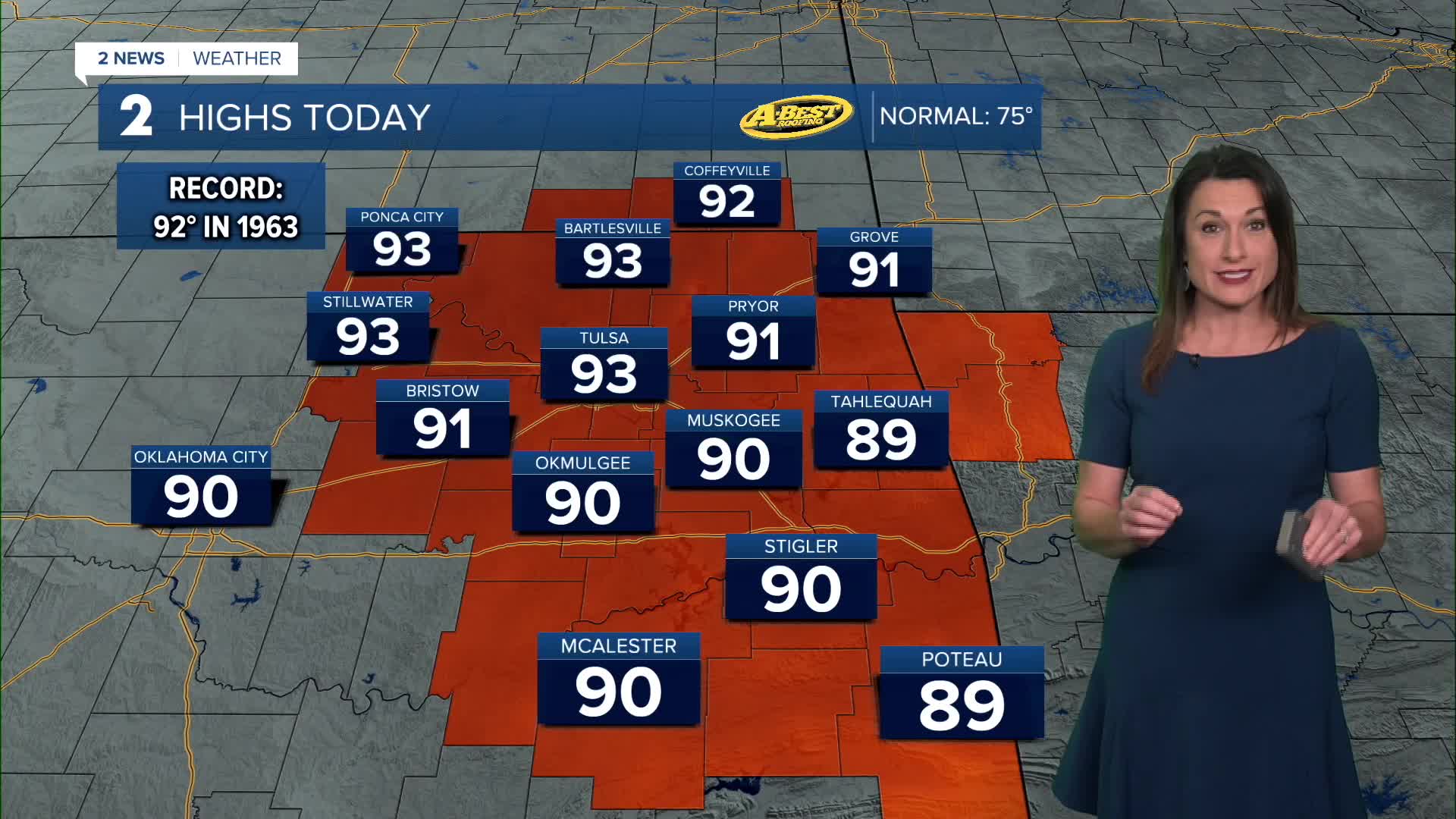


TULSA, OKLA — Another unusually warm day is expected with afternoon highs reaching record to near record levels in the upper 80s to mid-90s.
Partly to mostly sunny skies and breezy south winds will continue through the day. A few isolated showers or storms could develop Tuesday afternoon and evening, but widespread rainfall is not expected yet.
Rain and storm chances will increase late Tuesday night into Wednesday as Gulf moisture surges into eastern Oklahoma. Periods of rain and thunderstorms are expected to continue through Thursday night.
The heaviest rainfall is currently expected near and north of I-44. Many locations in this area could receive 1 to 3 inches of rain, with isolated totals reaching 5 inches through early Friday.
Locally heavy downpours could cause minor flooding in some areas, especially where storms repeatedly move over the same locations.
A few strong to severe storms will also be possible Wednesday with large hail and damaging wind gusts as the primary concerns with any severe storms that develop.
Rain chances will gradually decrease late Thursday night into Friday as a strong cold front moves through Green Country. Gusty north winds will usher in much cooler, drier air, bringing a noticeable end to the summer-like warmth.
Highs will fall into the 60s by the end of the week, with overnight lows dropping into the 40s over the weekend. Expect mostly dry conditions and comfortable fall weather to settle across the region.
Temperatures will begin to rebound early next week, with highs returning to the upper 70s and lower 80s by Monday. Low rain chances and a gradual warming trend are expected to follow.
 Facebook
  TikTok
  YouTube
 Instagram
 Threads
 X
X