

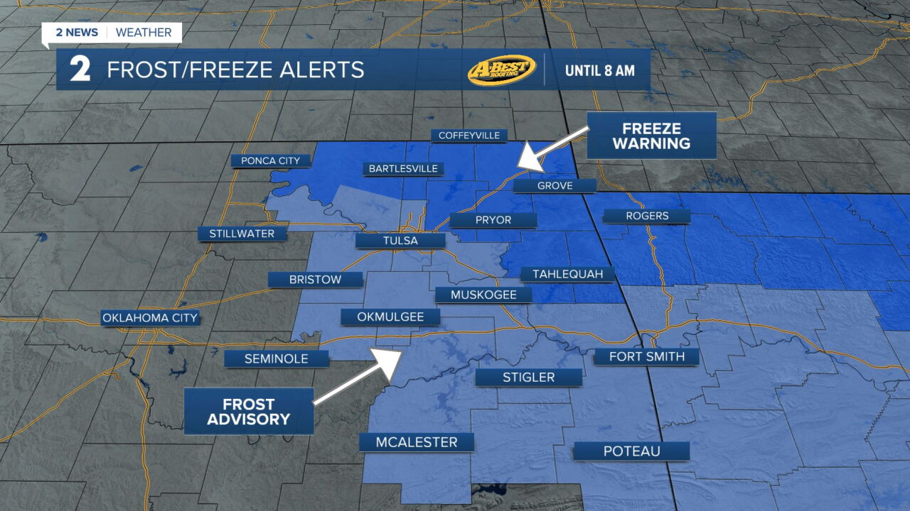


TULSA, OKLA — ***FROST AND FREEZE ALERTS IN EFFECT UNTIL 8 THIS MORNING.***
Starting off with some of the coldest air of the season with temperatures ranging from lower 30s north to mid-30s south.
A gradual warm-up with afternoon highs reaching the 50s across most of eastern Oklahoma and a few lower 60s possible in far southeast Oklahoma.
Another chilly morning is expected Saturday, with frost and freezing temperatures possible in many locations.
Temperatures will remain on the cool side through the day before rain chances return late Saturday night.
An approaching storm system will bring showers to much of the region from late Saturday night through Sunday evening.
Most locations could see at least some light rainfall, although dry air moving in from the east may limit how far north and east the rain spreads. The best chances for more substantial rainfall will be across southeast Oklahoma.
Cloud cover and rain will keep temperatures cool on Sunday, with highs staying in the 40s in areas that experience rain for much of the day. It will be a chilly, raw end to the weekend, with showers gradually tapering off by early Monday morning.
Drier and quieter weather is expected to return early next week as temperatures gradually warm. Highs should climb back toward seasonal averages by the middle of the week.
Another storm system could bring additional rain chances during the latter half of next week, although there is still considerable uncertainty regarding its timing and potential impacts.
 Facebook
 TikTok
 YouTube
 Instagram
 Threads
 X
