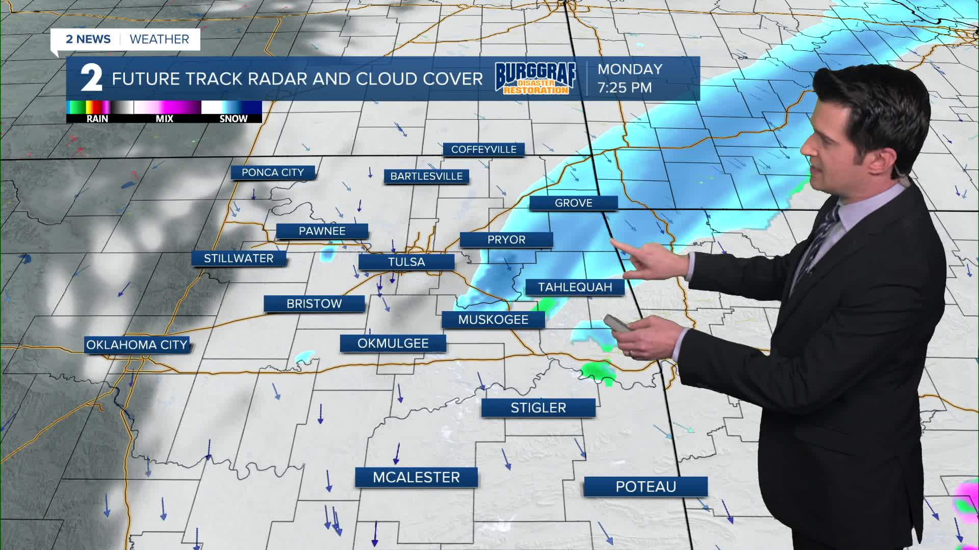


TULSA, Okla. — The snow showers will move out of eastern Oklahoma this evening with clearing skies working in overnight. The low in Tulsa down to 22°. Some outlying spots could dip into the upper teens. Light NW winds 5-10 mph.
Sunny skies on Tuesday with highs in the upper 40s. SSW winds 5-10 mph.
Partly cloudy on Wednesday with lows around 32° and then highs near 50°. A dry cold front will move through later in the day.
More clouds on Thursday with lows in the low 20s. But with NE winds 10-20 mph, it looks like morning wind chills will be down to the single digits and teens in Green Country. Afternoon highs only in the mid 30s.
Lows still in the lower 20s Friday morning with daytime highs in the upper 40s.
Mostly sunny on Saturday. The morning will start with around 30° and then afternoon temps in the mid 50s.
Another cold front will move through by Sunday with lows still around freezing and highs in the 40s.
Stay in touch with us anytime, anywhere --
- Download our free app for Apple, Android and Kindle devices.
- Sign up for daily newsletters emailed to you
- Like us on Facebook
- Follow us on Instagram
- Watch LIVE 24/7 on YouTube
