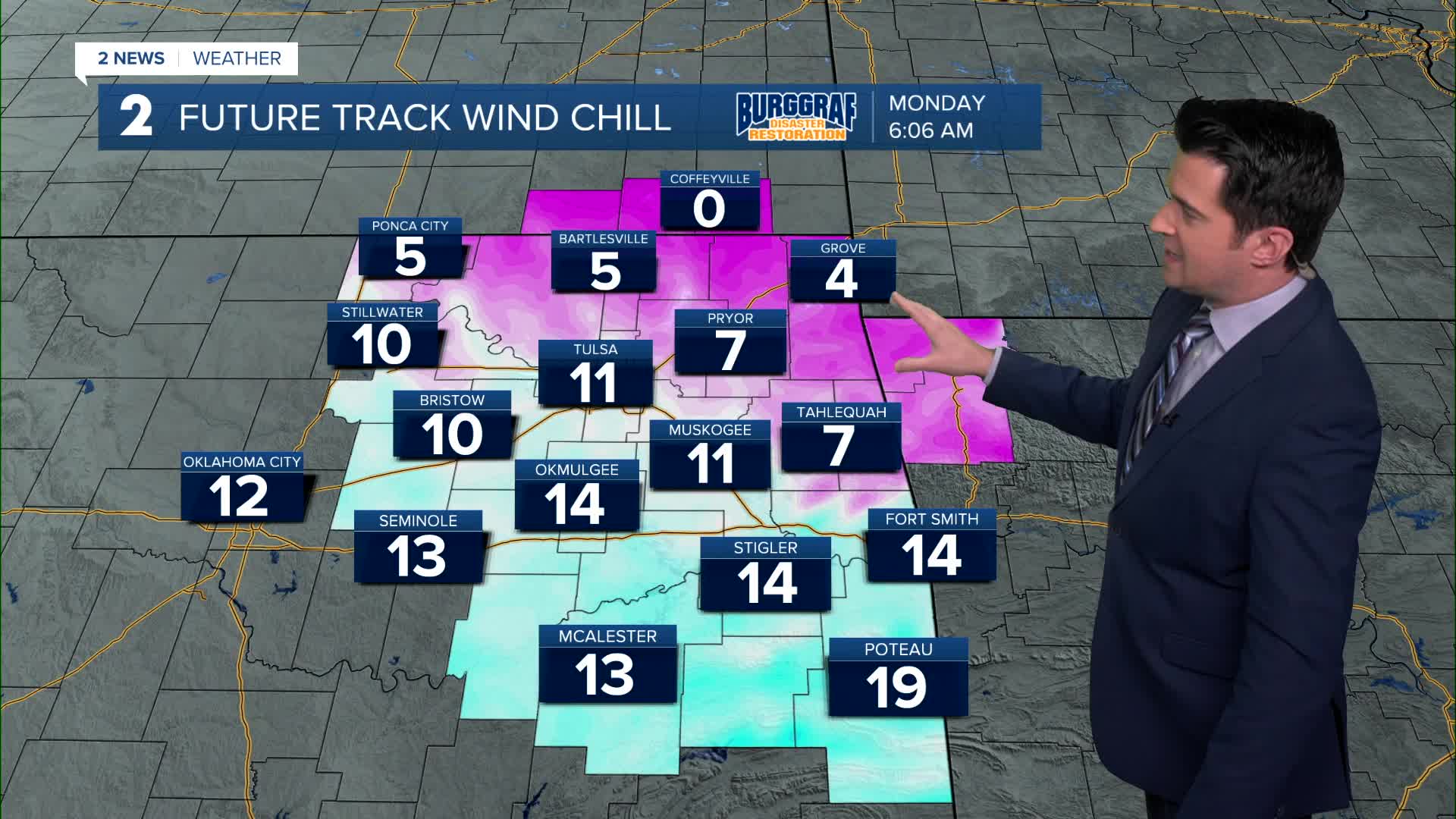


TULSA, Okla. — We'll see clearing skies tonight with NW winds 15-25 mph. Some gusts up to 30-35 mph. The low in Tulsa down to 22°, but wind chills area-wide in the single digits and teens tonight through Monday morning.
Mainly sunny on Monday with a very cold morning. North winds 15-25 mph with gusts up to 30-35 mph in the morning. Winds taper for the afternoon. The high around 37°.
Mostly sunny on Tuesday with lows around 20° and then highs near 50°.
Sunshine continues on Wednesday with morning temps near 30° and then daytime highs in the upper 50s.
To kick off 2026, mostly sunny on Thursday. Lows in the mid 30s and then highs in the 50s.
On Friday, slight chance for a few rain showers. The morning starts in the mid 30s and then 50s for highs.
As of now, next weekend doesn't look too bad. Sunshine with lows in the 30s and then afternoon temperatures reaching the mid 50s to around 60°.
Have a great week ahead!
Stay in touch with us anytime, anywhere --
- Download our free app for Apple, Android and Kindle devices.
- Sign up for daily newsletters emailed to you
- Like us on Facebook
- Follow us on Instagram
- Watch LIVE 24/7 on YouTube
