

***WIND ADVISORY FOR EASTERN OKLAHOMA UNTIL 1 AM MONDAY***
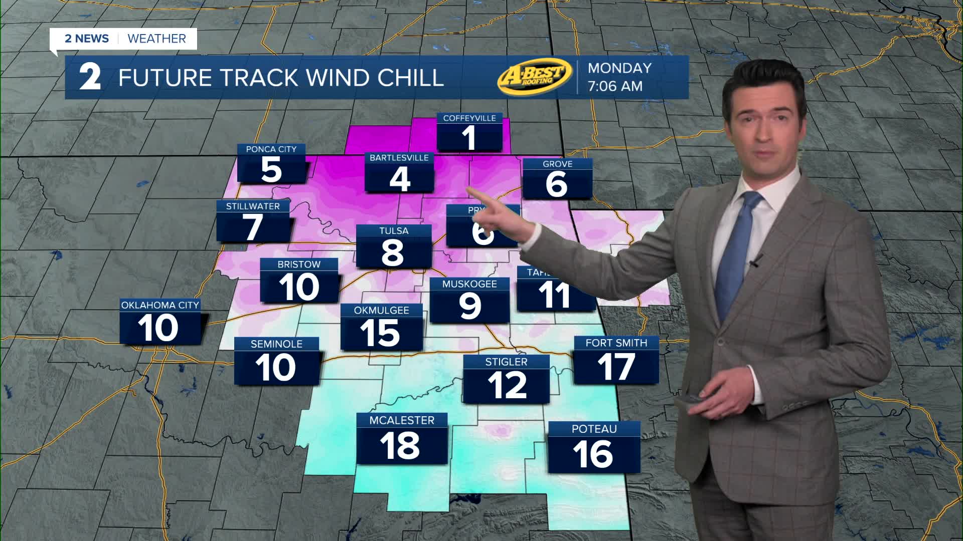
We'll have clear skies tonight with the low down to 22°. We could tie the record low of 22° from 1962. NW winds 20-30 mph with gusts up to 45 mph to 50 mph. Wind chills by morning in the single digits and teens.
Mostly sunny to sunny skies on Monday with the high up to 43°. NW 15-25 mph with gusts 30-35 mph.
Lows in the mid 20s on Tuesday and then highs in the low 60s. Partly cloudy skies. South 10-20 mph.
Temps Wednesday morning in the mid 40s with highs in the upper 70s. Mostly sunny skies. Southwest winds 10-20 mph.
Lows in the low 50s Thursday and then mid 80s in the afternoon. Mostly sunny.
Friday starts in the mid 50s and then rising to the upper 80s. Mostly sunny.
Over the weekend, lows in the upper 50s with highs in the mid to upper 80s. Lots of sunshine.
Our next cold front looks to come through by Sunday night or Monday morning with temperatures dropping.
Stay in touch with us anytime, anywhere --
- Download our free app for Apple, Android and Kindle devices.
- Sign up for daily newsletters emailed to you
- Like us on Facebook
- Follow us on Instagram
- Watch LIVE 24/7 on YouTube
