

TULSA, OKLA — We'll enjoy a pleasant night with lows in the mid/upper 40s by daybreak.
Southerly winds will increase again Saturday as a strong storm system approaches the region. However, returning moisture will keep humidity levels higher, which should limit the fire weather threat during that period. Highs Saturday afternoon in the upper 70s. Outdoor plans are a go!
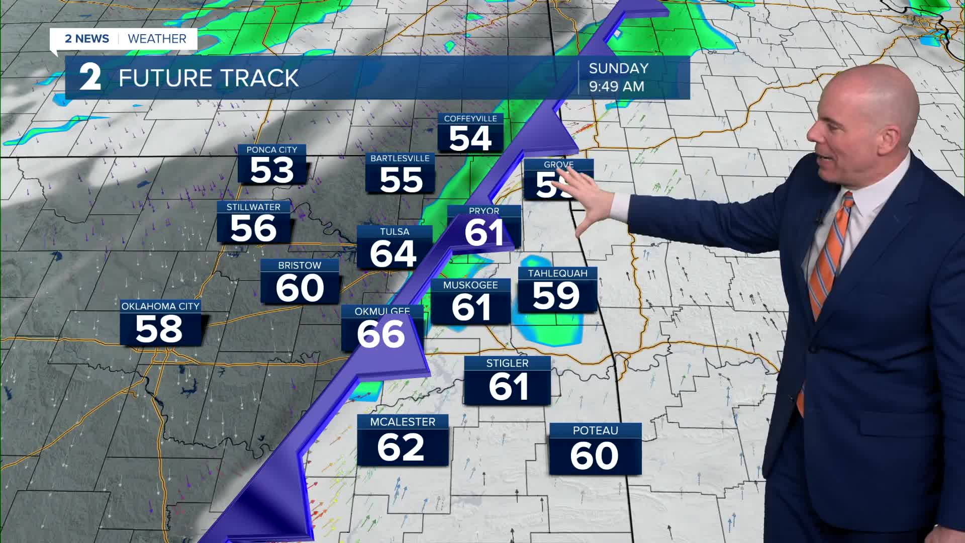
A strong cold front are expected to move across the region on Sunday. Ahead of the front, moisture and atmospheric lift could bring a narrow band of storms early Sunday afternoon, especially east of HWY 69.
There is a slight risk of severe weather, with damaging winds being the primary concern, east of HWY 69 from late morning to early afternoon. Timing of Sunday's cold front will be key. A quicker arrival equals a lower severe risk, but a slower arrival likely increases the risk. We'll be monitoring closely.
Once the cold front passes, winds will rapidly shift to the north and northwest and strengthen significantly. Current projections show widespread wind gusts of 40 to 50 mph across the region. These strong winds combined with falling humidity could again create conditions favorable for wildfire spread, even as colder air moves in.
Highs Sunday in the 60s, perhaps a few 70s, before tumbling into the 50s and 40s by late afternoon, and eventually into the 30s Sunday night! A few showers will be possible with perhaps a few snowflakes mixing in north of HWY 412. We are not anticipating any winter travel issues. Wind chills may reach the teens and single digits Monday morning with lows temps in the low/mid 20s.
Not as strong as Sunday, but gusty north to northwest winds will continue Monday, keeping conditions chilly and breezy with highs in the mid 40s.
The week will start out cold, but finish warm! Highs will return to the 60s on Tuesday, 70s on Wednesday, and 80s for Thursday and Friday!
Stay in touch with us anytime, anywhere --
- Download our free app for Apple, Android and Kindle devices.
- Sign up for daily newsletters emailed to you
- Like us on Facebook
- Follow us on Instagram
- Watch LIVE 24/7 on YouTube
