

TULSA, OKLA — After a cool and comfortable start to the week, temperatures will steadily climb through midweek as southerly winds return warmer, more humid air to the region.
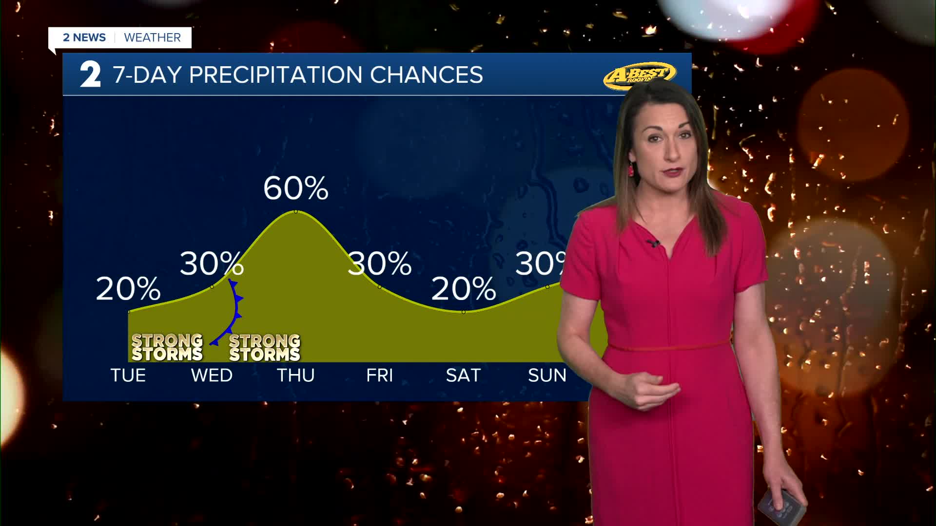
Mostly sunny for Tuesday with afternoon highs reaching the upper 80s. As humidity increases, heat index values likely to reach the mid-90s. While most locations will remain dry, isolated thunderstorms may develop late in the afternoon, mainly north of Tulsa and near the Oklahoma-Kansas border. Any storms that form are expected to weaken around sunset, though a few could produce strong winds and large hail.
Wednesday will be the hottest day of the week. Morning temperatures will remain in the 70s, and afternoon highs will climb into the upper 80s and low to mid-90s. Strong south winds will push moisture levels higher, with dew points returning to the 70s. As a result, heat index values could reach 100 to 105 degrees in some locations.
A cold front approaching the region Wednesday night will increase the likelihood of showers and thunderstorms. Storms are expected to develop first across northern Oklahoma, including areas north of Tulsa, during the evening hours.
Some of these storms could become severe, producing damaging winds, large hail, and locally heavy rainfall. The greatest severe weather risk appears to be north of I-40.
As the front moves southward overnight and through Thursday, rain and thunderstorms will become more widespread across the region. Heavy rainfall may lead to localized flash flooding in some areas.
Behind the cold front, temperatures will fall back below normal for mid-June. Cloud cover, rainfall, and north winds will help keep daytime highs in the 80s on Thursday and Friday.
Rain chances will gradually decrease by late Friday as the storm system exits the area.
A brief break in rainfall is expected late this week, but the pattern is not expected to stay dry for long.
Temperatures will begin to rebound over Father's Day weekend, climbing back toward the 90-degree mark. However, another weather system is expected to approach late Sunday and continue into next week.
Stay in touch with us anytime, anywhere --
- Download our free app for Apple, Android and Kindle devices.
- Sign up for daily newsletters emailed to you
- Like us on Facebook
- Follow us on Instagram
- Watch LIVE 24/7 on YouTube
