

TULSA, OKLA. — We'll see some rain showers tonight with the low in Tulsa down to 52°. South winds then north winds behind a cold front 10-15 mph with gusts to 25 mph.
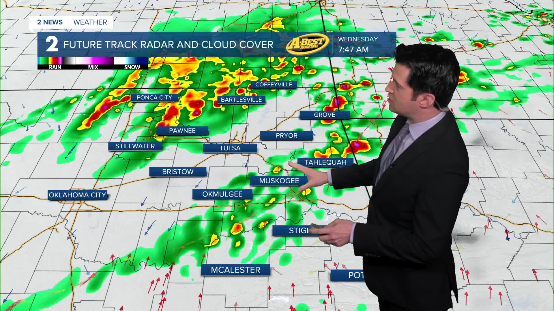
Cloudy skies with scattered showers and t-storms on Wednesday through the day. The activity starts early in the morning. Some storms could be strong to severe with a wind and hail threat. Highs in the upper 50s. North winds 5-15 mph. There is a lower end tornado threat southeast of Tulsa afternoon to early evening.
Lows around 50° Thursday with highs in the low 70s. Mostly cloudy skies with the chance for a few showers and t-storms. A better chance for them moving in later Thursday night with a wind and hail threat.
Morning temps in the low 60s on Friday with highs in the mid 70s. Mostly cloudy skies with scattered showers and t-storms. Some of the storms could be strong to severe from the afternoon through much later at night. All modes will be possible with a tornado threat, large hail, and damaging gusty winds.
Lows down to the 40s Saturday morning behind a cold front. Highs in the low 60s. Partly cloudy skies. There could be a few showers left, mainly exiting before sunrise.
On Sunday, temps in the 40s to begin the day once again with highs warmer in the mid 70s. Mostly sunny skies.
Showers and thunderstorms could return again by early the following week around Monday or Tuesday.
Stay in touch with us anytime, anywhere --
- Download our free app for Apple, Android and Kindle devices.
- Sign up for daily newsletters emailed to you
- Like us on Facebook
- Follow us on Instagram
- Watch LIVE 24/7 on YouTube
