

***RED FLAG WARNING 11 AM UNTIL 8 PM SUNDAY FOR ALL OF THE FORECAST AREA***
We'll see mostly clear to clear skies tonight with areas of smoke and haze due to multiple fires in the area. South winds 5-15 mph. The low in Tulsa down to 65°.
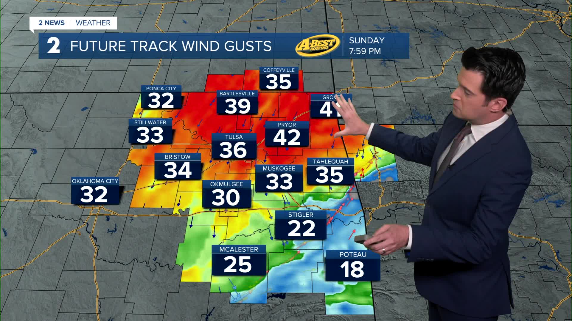
Mostly sunny on Sunday with south winds and then turning north mid to late afternoon as a cold front comes in. Speeds 15-25 mph with gusts 30-35 mph. Any current fires will have erratic behavior the second part of the day with the wind shift behind the cold front. The high up to 92°. The record high in Tulsa for the date is 94° from 1995.
Partly cloudy on Monday. Lows in the upper 40s. Highs in the upper 60s. NE winds 10-20 mph.
Lows down to the upper 40s again on Tuesday with daytime highs in the mid 70s. Slight chance for a rain shower or two early in the morning, otherwise a mostly sunny day. SE winds 5-15 mph.
Mainly sunny skies on Wednesday. Lows in the upper 50s with highs around 89°. We could break the record high. The record for the date is 88° from 1910. South winds 5-15 mph.
On Thursday, morning lows in the mid 60s. South winds 10-20 mph. We could be close to the record of 94° from 2020. We are forecasting 93° in Tulsa. Mainly sunny skies.
Our next front is scheduled to move through Thursday night and overnight. Lows Friday in the 50s with highs in the low 70s. Partly cloudy with a slight chance for rain showers on Friday. It could be quite gusty behind the front.
Have a great rest of the weekend and stay cool!
Stay in touch with us anytime, anywhere --
- Download our free app for Apple, Android and Kindle devices.
- Sign up for daily newsletters emailed to you
- Like us on Facebook
- Follow us on Instagram
- Watch LIVE 24/7 on YouTube
