

***WIND ADVISORY FOR ALL OF GREEN COUNTRY ON SUNDAY***
We'll see partly to mostly cloudy skies tonight with gusty winds increasing. South 15-30 mph with gusts up to 40-45 mph, especially well after midnight. Temperatures stay in the 60s.
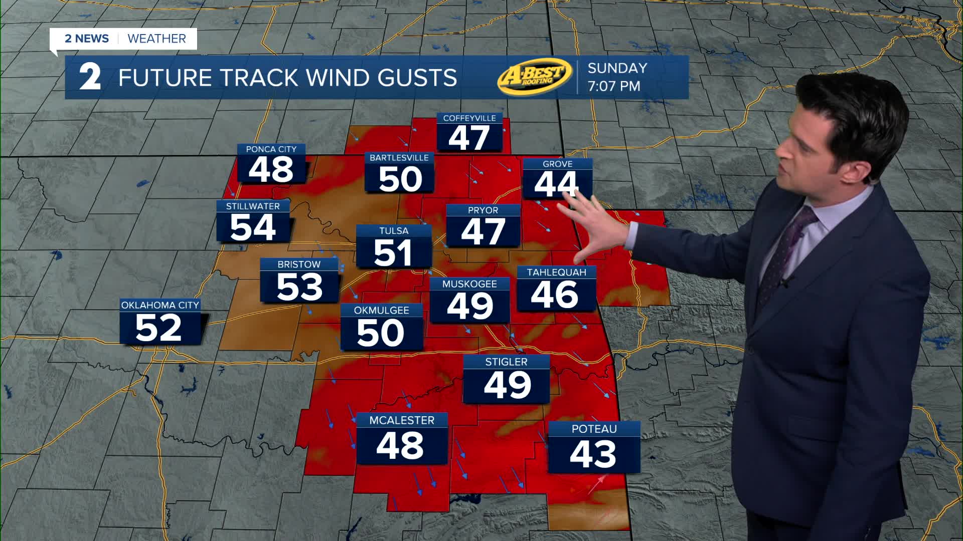
Temperatures in the 60s to near 70° early to the middle part of Sunday morning with gusty winds. Then a cold front will move through switching the winds to out of the northwest. Temperatures will drop, probably ending up in the mid 40s by 5pm. Northwest gusts 50-55 mph. Some isolated spots nearing 60 mph. The front could also kick up an isolated strong to severe storm very late morning and into the early afternoon in far eastern Oklahoma. Wind and hail will be the main threats. The highest chance for scattered showers and storms Sunday will be east into Missouri and Arkansas.
Then the low Monday morning down to 23°. We'll be around the record low of 22° from 1962. The wind chill drops to 9° early in the morning. Early morning wind chills area-wide will be in the single digits and teens. Mostly sunny skies with highs in the mid 40s. Northwest winds 15-20 mph.
Another hard freeze for Tuesday morning with the forecast being 25°. Wind chills near 20°. Partly to mostly cloudy skies with a high into the low 60s. South winds 10-20 mph.
Mostly sunny Wednesday with lows in the 40s and highs in the upper 70s. Southwest winds 10-20 mph.
Low 50s to start Thursday and then daytime highs in the mid 80s. Mostly sunny.
We'll start Friday in the mid 50s and then upper 80s. Another mostly sunny day.
As of now for next weekend, there is some question if a cold front will pass through by Sunday. For now, we are going with lows in the 50s Saturday and highs well into the 80s. If the front comes through by Sunday, highs will be in the 70s. But highs very well could continue to be in the 80s on Sunday. We'll keep you posted.
Stay in touch with us anytime, anywhere --
- Download our free app for Apple, Android and Kindle devices.
- Sign up for daily newsletters emailed to you
- Like us on Facebook
- Follow us on Instagram
- Watch LIVE 24/7 on YouTube
