

TULSA, OKLA. — Partly to mostly cloudy skies tonight with the low in Tulsa down to 46°. Slight chance for an isolated rain shower or two, especially north and east of the metro. South winds and then north winds 5-15 mph.
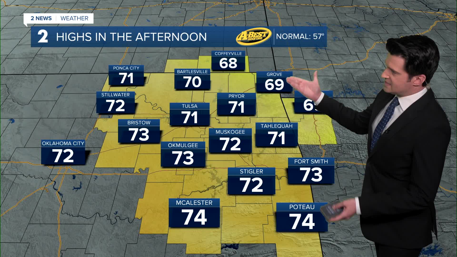
A shower or two could be around very early in the morning on your Thursday. Highs around 71°. Mostly sunny skies. North winds 5-10 mph.
Morning temperatures on Friday in the low 40s with daytime highs in the upper 70s. Mostly sunny to sunny skies and southwest winds 5-15 mph.
Lows around 50° Saturday morning with highs reaching the low 80s. Mostly sunny skies. Chance for a few showers and t-storms by later Saturday night.
Models are still having a hard time with temperatures Sunday onward. Here's what we are looking at as of this update. Lows Sunday morning around 50° with highs from the mid 60s to around 70° in the Tulsa area. There is going to be a big temperature gradient across eastern Oklahoma on Sunday from north (cooler) to south (much warmer) as a front is draped across Green Country. Look for scattered rain showers and t-storms along with mostly cloudy skies.
Lows around 40° Monday and Tuesday with highs in the mid 50s to near 60°. More showers will be moving through the region.
For Wednesday, more showers are in the forecast with lows in the mid 40s and highs in the mid 60s.
It does look quite active from Sunday and into much of next week. We will take all the rain we can get with the ongoing drought and fires.
Stay in touch with us anytime, anywhere --
- Download our free app for Apple, Android and Kindle devices.
- Sign up for daily newsletters emailed to you
- Like us on Facebook
- Follow us on Instagram
- Watch LIVE 24/7 on YouTube
