

TULSA, OKLA. — We'll see partly to mostly cloudy skies tonight with the low in Tulsa down to 48°. Chance for a stray shower and/or t-storm. South winds and then NE winds 10-15 mph with gusts up to 25 mph as a cold front works into our area.
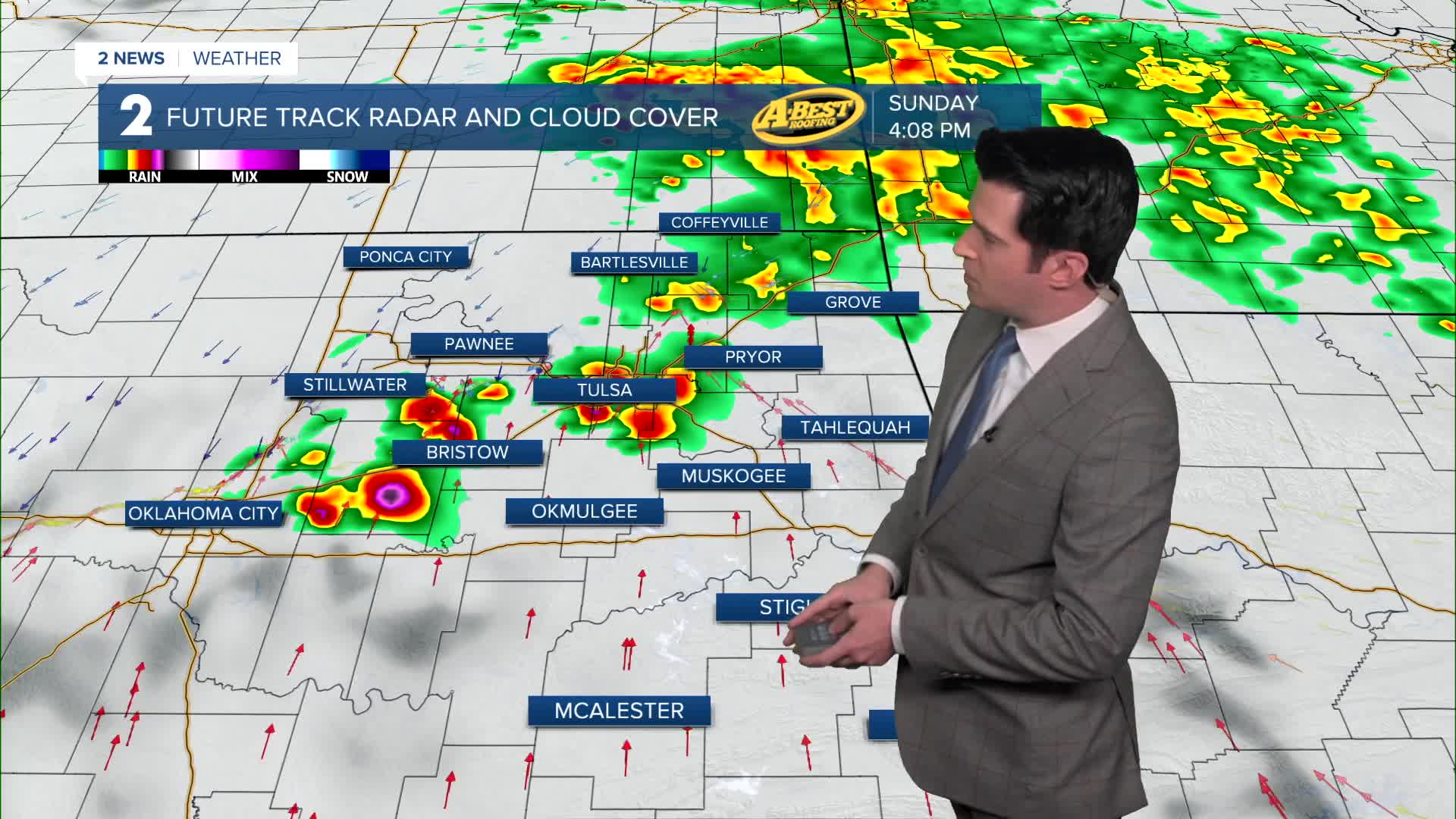
Mostly cloudy skies on Sunday with a 60% chance for some showers and t-storms. High temperatures will be all over the place across Green Country with a stalled out cold front. We are anticipating that highs will be in the 50s well north of Tulsa, with possibly up to 65° in Tulsa, and then our southern counties will be in the 70s to near 80°. NE winds 10-15 mph with gusts to 25 mph.
Lows in the 40s on Monday with highs in the 60s. Mostly cloudy skies with a chance for some showers and t-storms. SE winds 5-15 mph.
Lows warmer on Tuesday in the mid 50s and then near 80° in the afternoon. 20% chance for showers. South winds 15-25 mph.
A cold front comes in by Wednesday with a chance for more showers and t-storms. Some of the storms could be strong to severe, especially across our far southern counties. Lows in the 50s with highs near 70°. North winds 10-15 mph.
Partly cloudy skies with a slight chance for showers and t-storms on Thursday. Lows in the low 50s with highs in the mid 70s.
Lows in the 50s with daytime highs in the low 70s on Friday. Mostly cloudy skies with a chance for some showers and t-storms.
Then another front is forecast to move in by Saturday with, you guessed it, more showers and t-storms. Lows in the 50s and then highs in the 60s behind the frontal boundary.
Have a great rest of the weekend!
Stay in touch with us anytime, anywhere --
- Download our free app for Apple, Android and Kindle devices.
- Sign up for daily newsletters emailed to you
- Like us on Facebook
- Follow us on Instagram
- Watch LIVE 24/7 on YouTube
