

TULSA, OKLA — Bundle up Sunday!
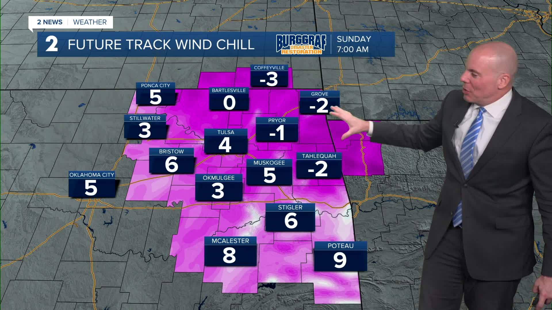
Low temps will range from mid teens to low 20 with wind chills in the single digits to perhaps below zero in a few spots north. Despite lots of sunshine, afternoon highs will be chilly in the lower 30s!
After a cold Monday morning with lows in the low/mid 20s. Temperatures will steadily climb warmer next week. After a seasonably cool Monday afternoon with highs in the upper 40s. Then we'll see low 60s possible as early as Tuesday, Wednesday, and Thursday.
Rain chances look slim, but we'll add a slight shower chance on Thursday with another front approaching.
Overall above average temps look to be the rule even into next weekend.
Stay in touch with us anytime, anywhere --
- Download our free app for Apple, Android and Kindle devices.
- Sign up for daily newsletters emailed to you
- Like us on Facebook
- Follow us on Instagram
- Watch LIVE 24/7 on YouTube
