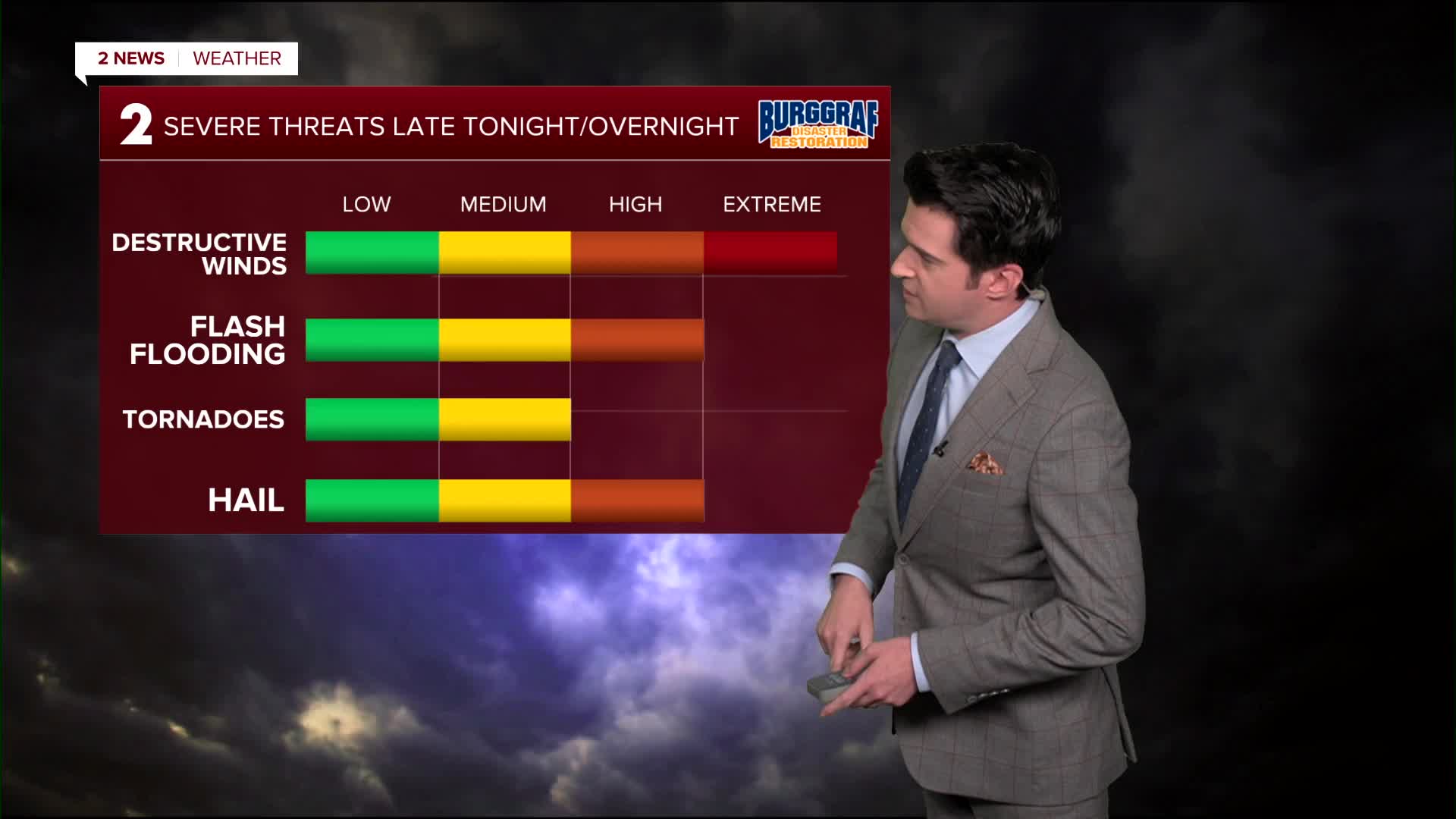


**Flood Watch for all of NE Oklahoma and SE Kansas until 1 p.m. Wednesday**
Showers and storms will be ongoing Wednesday morning, then coming to an end mid to late morning. Then another batch of strong to severe storms could move through in the afternoon and evening. All modes of severe weather will be possible with these. The high reaching 86° in Tulsa. SW winds 10-20 mph.
Some fog is possible Thursday morning, otherwise partly cloudy to mostly sunny. Lows in the upper 60s and highs in the low 90s.
Mostly sunny on Friday with lows in the low 70s and highs in the mid 90s. Gusty south winds. The heat index could reach 103°. The summer solstice starts at night.
Over the weekend, mostly sunny and continued dry. Lows in the mid 70s and highs in the low 90s. Gusty south winds. The heat index from the upper 90s to the low 100s.
Early next week, lots of sunshine with lows still in the 70s and highs in the low 90s. The breezes will hold on, at least on Monday.
Stay in touch with us anytime, anywhere --
- Download our free app for Apple, Android and Kindle devices.
- Sign up for daily newsletters emailed to you
- Like us on Facebook
- Follow us on Instagram
- Watch LIVE 24/7 on YouTube
