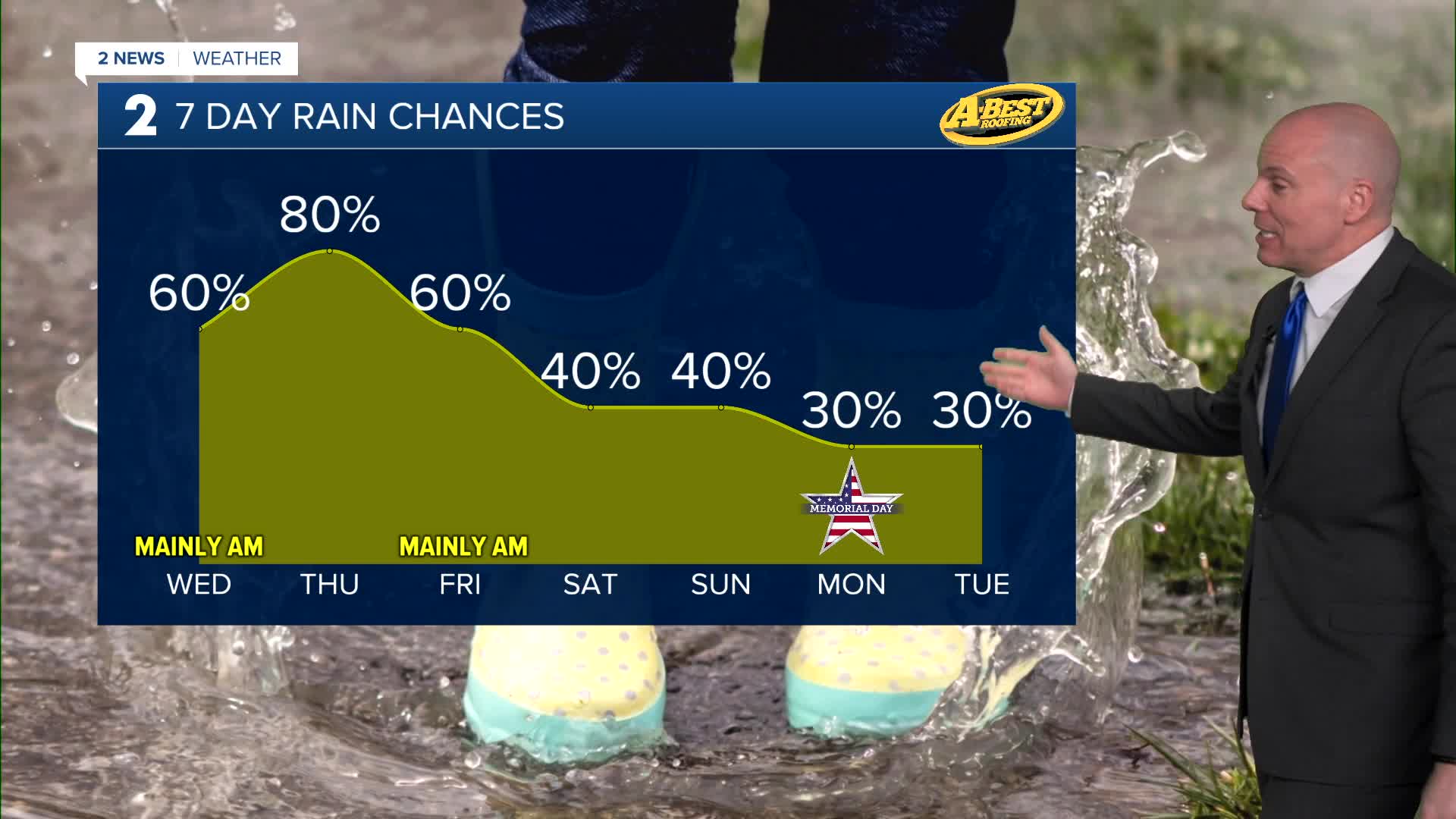


TULSA, OKLA — An unsettled weather pattern continues for the rest of the week.
A few spotty showers, and perhaps rumbles of thunder, will be possible into Wednesday morning. Widespread heavy rain is not expected. These will likely diminish into Wednesday afternoon, but we'll keep the slight chance of a stray shower or two in the forecast. Temperatures will continue to run below average with highs ranging from mid/upper 60s north to low/mid 70s south. Temperatures will be highly dependent on how much or how little sunshine an area sees.
Another round of widespread rain and thunder is expected Thursday and temperatures will once again struggle to warm up. While the severe weather threat remains low, heavy rainfall could lead to flash flooding in a few locations. Friday rain chances look lower, but we'll still have a chance for a few hit-or-miss showers and storms. Temperatures are expected to warm up with a bit more sunshine filtering through.
The rest of the holiday weekend may have more wet or stormy spells. Gradually warmer conditions take hold despite mostly cloudy skies and the potential for more rain. Highs return to the lower 80s in this window of time. Don't cancel outdoor plans, but have an indoor alternative just in case.
Shower and storm chances continue through much of next week as well.
Stay in touch with us anytime, anywhere --
- Download our free app for Apple, Android and Kindle devices.
- Sign up for daily newsletters emailed to you
- Like us on Facebook
- Follow us on Instagram
- Watch LIVE 24/7 on YouTube
