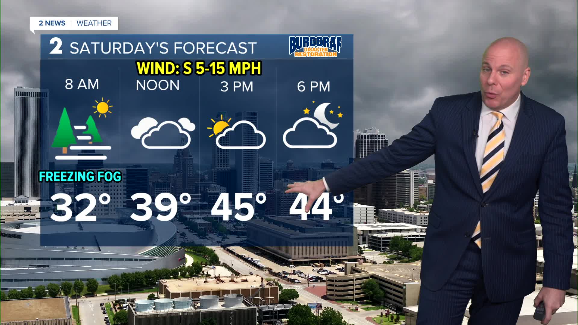


TULSA, OKLA — Saturday morning will be similar to what we saw Friday morning with fog developing overnight. Where temps drop to freezing, freezing fog will be possible which could lead to a few slick spots on bridges and overpasses. Visibility could drop below 1/4 mile in some spots as well.
Much like Friday, how quick or slow the fog and and clouds clear will be the determining factor to how warm we get in the afternoon. Our current forecast has highs in the mid 40s, but may need to be adjusted depending on trends.
Behind a cold front on Sunday, gusty northwest winds and chilly temperatures will return. Lows in the mid 30s with highs in the low 40s under a partly to at times mostly cloudy sky.
A warming trend is slated for next week. However, Monday still looks chilly with morning temps in the mid 20s with daytime highs in the mid 40s.
Highs will likely return to the 50s for Tuesday with near to slightly above average temps through the middle of next week.
The morning on Wednesday will start out in the upper 30s to low 40s and then finish in the mid 50s. Thursday may end up our warmest of next week with highs in the low/mid 60s! Enjoy it as another cold front is likely to drop temperatures for next Friday. Overall, the forecast looks dry through next week.
Stay in touch with us anytime, anywhere --
- Download our free app for Apple, Android and Kindle devices.
- Sign up for daily newsletters emailed to you
- Like us on Facebook
- Follow us on Instagram
- Watch LIVE 24/7 on YouTube
