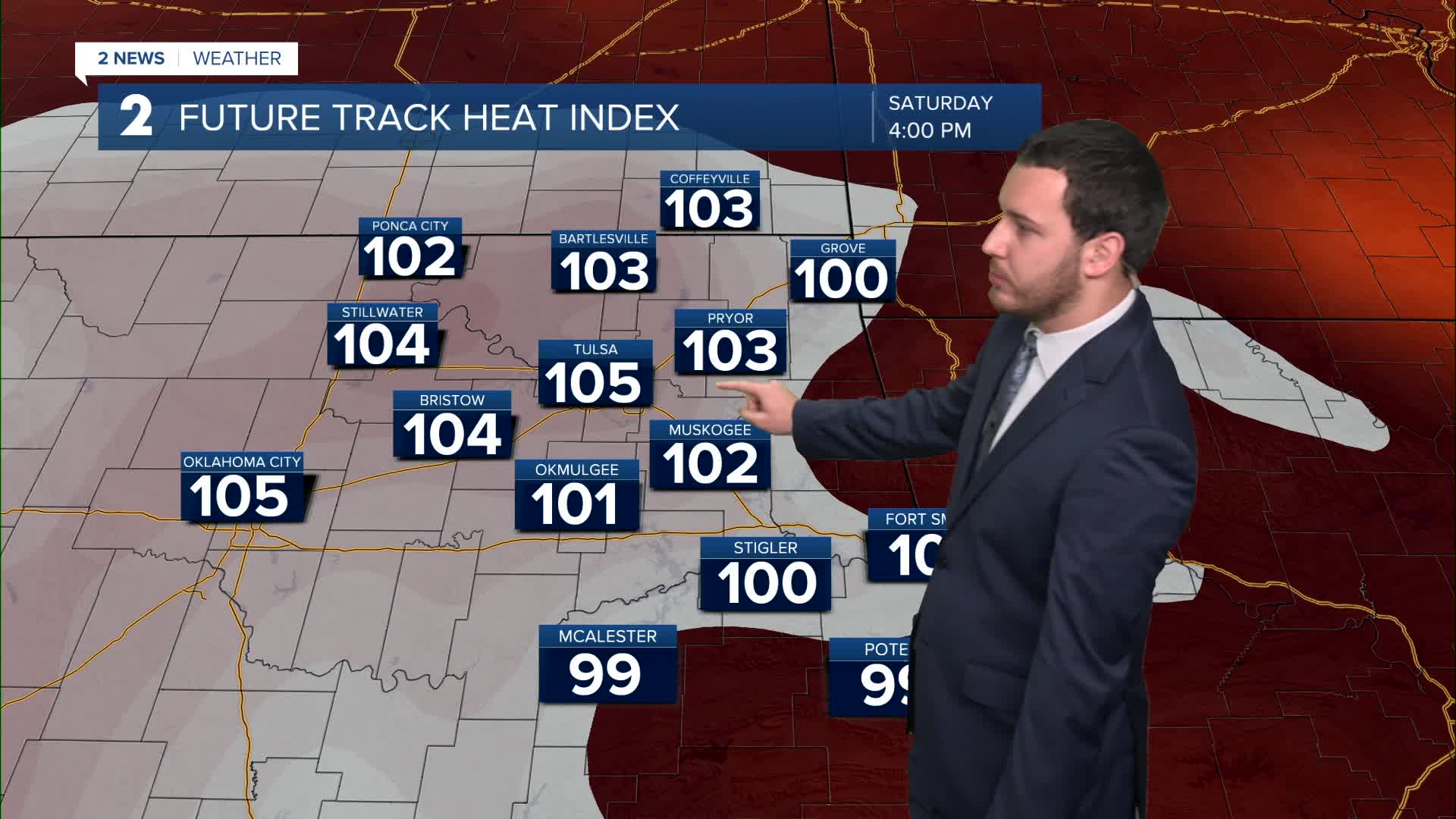


Scattered showers will move through during the morning hours that will become more isolated as the morning progresses. Showers should wrap up around the late morning and give way to sunshine for the afternoon. Temps will warm back up around the 90° mark. Heat indices will once again be in the triple digits in many areas. Winds will be gusty out of the south.
High water levels can be expected at the lakes as well as many rivers and it will take a couple days for water levels to fall back down to normal levels. Flooding will be a concern for some rivers going through the rest of the weekend.
Lows will be in the upper 70s tonight.
Warmer temperatures and humid conditions can be expected to end the weekend and much of next week as a ridge will build in decreasing rain chances and increasing the heat.
Sunday will once again see highs in the low 90s with heat indices in the triple digits. Lows will be once again in the upper 70s. Winds will once again be gusty and out of the south.
Next week will follow a similar pattern as Sunday with plenty of heat and humidity. Heat advisories may be issued in the middle of the week as temps continue to climb.
Rain chances will start to increase for July Fourth weekend with the summer heat and humid conditions still sticking around.
Stay in touch with us anytime, anywhere --
- Download our free app for Apple, Android and Kindle devices.
- Sign up for daily newsletters emailed to you
- Like us on Facebook
- Follow us on Instagram
- Watch LIVE 24/7 on YouTube
