

***TORNADO WATCH UNTIL 4 AM FOR SOUTHEAST KANSAS***
Chance for an isolated storm or two overnight tonight, mainly well north of the Tulsa metro around the Oklahoma and Kansas line. Wind and hail the main threats. The low in Tulsa only down to 70°. South 10-20 mph with gusts up to 25-30 mph.
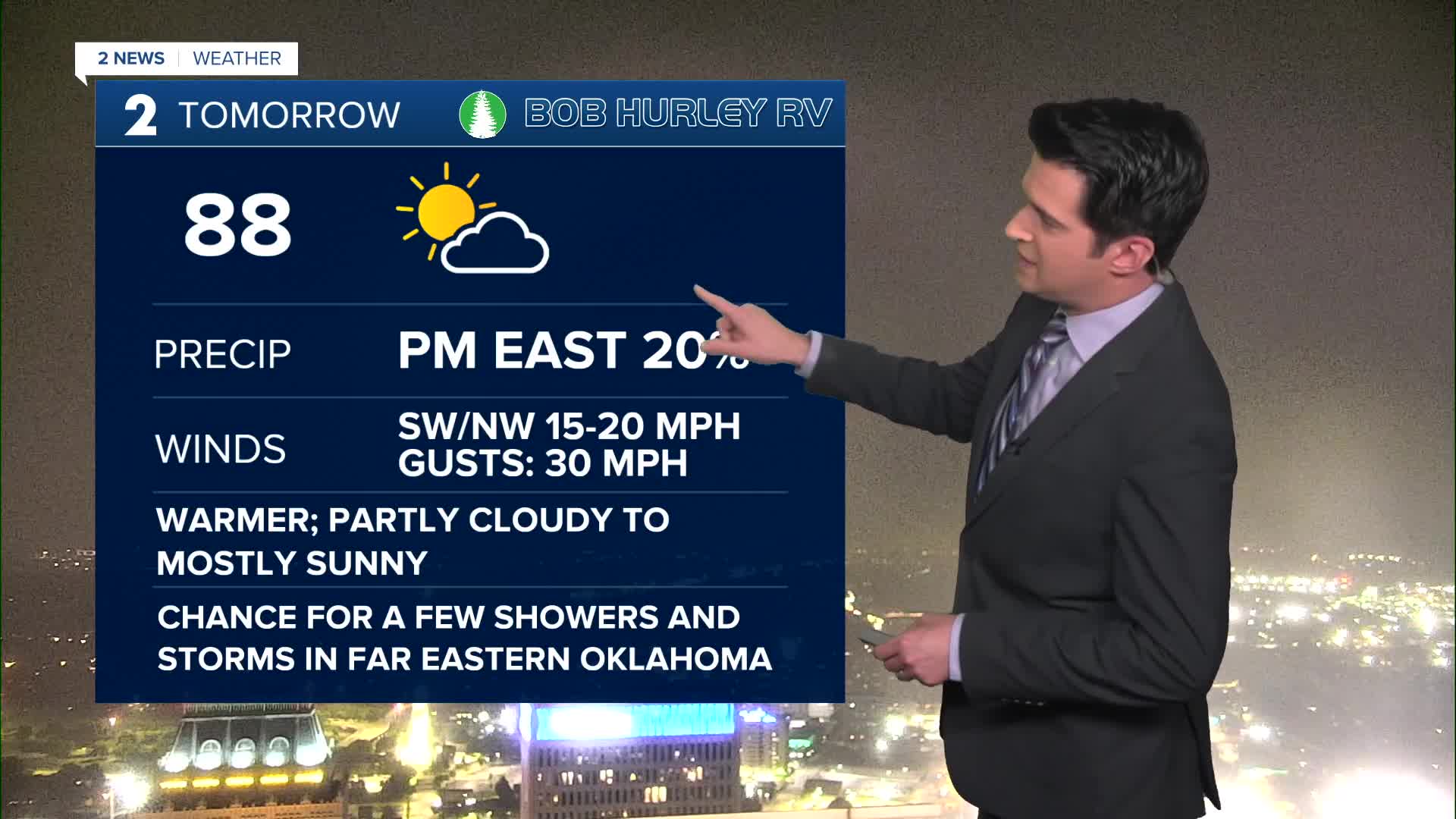
Partly cloudy to start Monday and then turning mostly sunny. The high up to 88°. Southwest winds and then northwest winds later in the day as a cool front comes in. Gusts up to 30 mph. As the front comes in, slight chance for a few strong to severe storms in far eastern Oklahoma with mainly a wind and hail threat. Most storms should be in Missouri and Arkansas.
Behind the front Tuesday morning, lows in the mid 50s. Highs in the low 70s. Mostly cloudy skies with a chance for some showers and t-storms. Chance for strong to severe storms in far southeast Oklahoma.
Mostly sunny on Wednesday with low 50s to start and then low 70s for highs.
On Thursday and Friday, mostly cloudy skies with a chance for rain showers. Lows from the upper 40s to the low 50s and then highs in the upper 60s. The severe risk is looking very low at this time.
Over next weekend, it doesn't look too bad. Morning temps around 50° with highs in the low to the mid 70s. Slim chance for a shower on Saturday with some sunbreaks and then partly cloudy and dry on your Sunday.
Have a great week ahead!
Stay in touch with us anytime, anywhere --
- Download our free app for Apple, Android and Kindle devices.
- Sign up for daily newsletters emailed to you
- Like us on Facebook
- Follow us on Instagram
- Watch LIVE 24/7 on YouTube
