

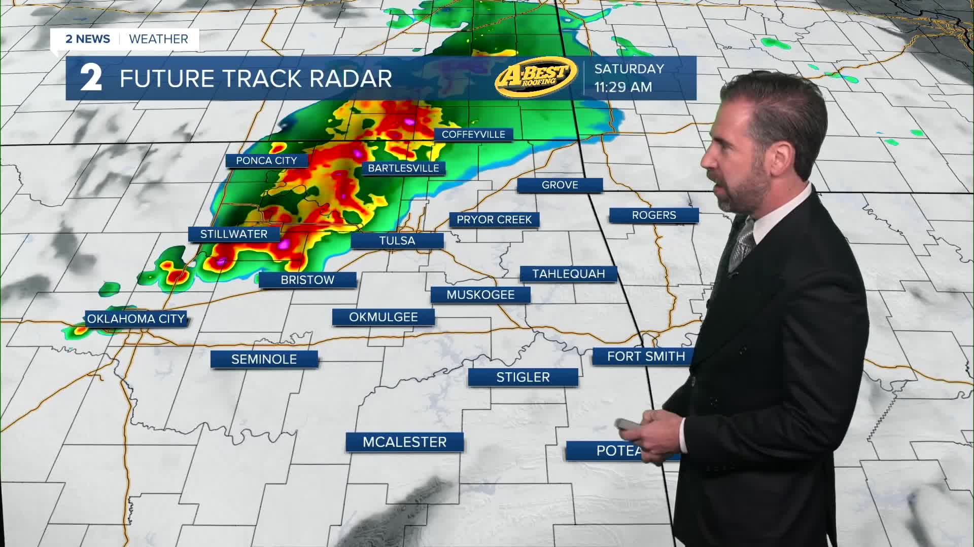


TULSA, OKLA — Quiet, warm and humid conditions are with us tonight and early Saturday morning as temperatures dip into the 70s for lows.
Another round of rain and storms is likely Saturday morning into midday. A few storms may be strong or severe with locally damaging wind gusts being the main hazard beyond lightning and torrential downpours. Skies should gradually clear during the afternoon leading to a drier rest of the day.
The clouds and rain will keep temperatures cooler on Saturday. Highs following any wet weather will only reach the lower to mid-90s for most locations.
On Sunday, a round of rain and thunder cannot be ruled out. Otherwise, expect a hot, increasingly breezy day. The heat index will top 100° again.
Highs early next week will climb again above the century mark with heat index values running in a dangerous range by afternoon through Tuesday.
A disturbance or two may push through Green Country early next week, bringing periodic chances for isolated showers and thunderstorms. Those chances should diminish after Wednesday.
Following a modest midweek cool-down, triple-digit temperatures likely make a return for the final days of August.
Stay in touch with us anytime, anywhere --
- Download our free app for Apple, Android and Kindle devices.
- Sign up for daily newsletters emailed to you
- Like us on Facebook
- Follow us on Instagram
- Watch LIVE 24/7 on YouTube
