

Severe Thunderstorm Watch for Adair, Cherokee, Craig, Creek, Delaware, Haskell, Hughes, Latimer, Le Flore, McIntosh, Mayes, Muskogee, Nowata, Okfuskee, Okmulgee, Osage, Ottawa, Pawnee, Pittsburg, Rogers, Sequoyah, Tulsa, Wagoner and Washington County in OK until 3:00am.
Another complex of showers and storms is expected to track across Green Country this evening into tonight. Window for storms will be between about 8pm to 2am, but may very an hour or two depending on how quickly storms initiate this evening. A threat for severe storms will exist over all of Green Country, but the threat is slightly higher south of HWY 412, and especially near and south of I-40.
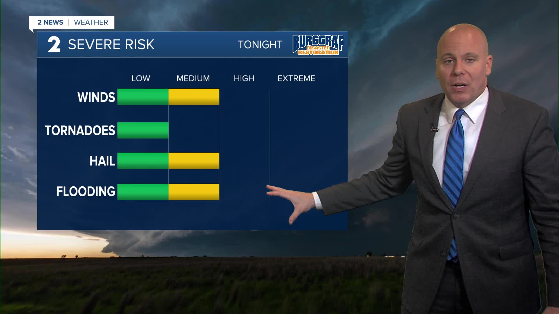
Main severe threat will be damaging wind gusts of 60-80 mph and potential for 1" to 2" diameter hail. The hail threat will be highest as storms first develop, an should lower as storms converge. There is also a small window for a tornado or too, but overall the tornado threat stays low.
Flooding is also a concern as a FLOOD WATCH remains in effect along and south of I-40. these are the same areas that saw heavy rain Monday night into early Tuesday. Be mindful for rising water in flood prone areas and along area creeks and rivers.
Most of the rain should be out of our area for the morning commute Wednesday with lots of sunshine returning bu afternoon. Highs in the mid/upper 80s with light northerly winds.
Thursday looks quite warm ahead of an approaching cold front. Temps could push 90-degrees depending on the timing of the front. We'll drop back into the mid/upper 80s on Friday.
The active pattern returns with another chance of storms Friday night and likely continuing into the upcoming weekend with the highest chances in the late night to early morning hours.
WATCH 2 News Weather 24/7 on YouTube.
Stay in touch with us anytime, anywhere --
- Download our free app for Apple, Android and Kindle devices.
- Sign up for daily newsletters emailed to you
- Like us on Facebook
- Follow us on Instagram
- Follow us on Twitter
