

TULSA, Okla. — We'll see some scattered showers and storms across eastern Oklahoma tonight and overnight. A few strong to severe storms could pop up with a wind and hail threat. Lows in the mid to upper 60s.
Partly cloudy on Monday with maybe a few showers and storms through the day, but it shouldn't be as stormy as today. Highs in the mid 80s. SE winds 5-15 mph.
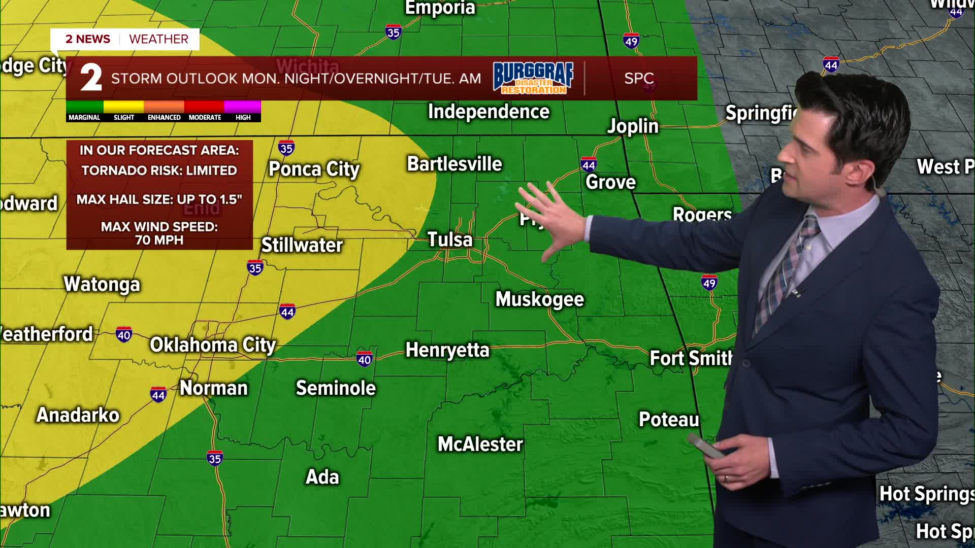
But then primarily past midnight into Tuesday morning, showers and storms will develop across the area with all modes of severe weather possible. We'll be watching out for wind, hail, flash flooding, and a tornado risk.
We'll start Tuesday morning in the lower 70s with highs in the low 80s. Mostly cloudy to cloudy skies with maybe more showers and storms forming Tuesday afternoon and night.
A front will move through by Wednesday with lows in the mid 60s. North winds come in. Highs in the upper 70s. Mostly cloudy with maybe a few showers and storms leftover.
We go back to dry weather Thursday through the weekend with nice sunshine coming in. Lows from the upper 50s and low 60s and then highs in the upper 70s on Thursday and then low 80s Friday through the weekend.
Have a great first week of fall!
Stay in touch with us anytime, anywhere --
- Download our free app for Apple, Android and Kindle devices.
- Sign up for daily newsletters emailed to you
- Like us on Facebook
- Follow us on Instagram
- Watch LIVE 24/7 on YouTube
