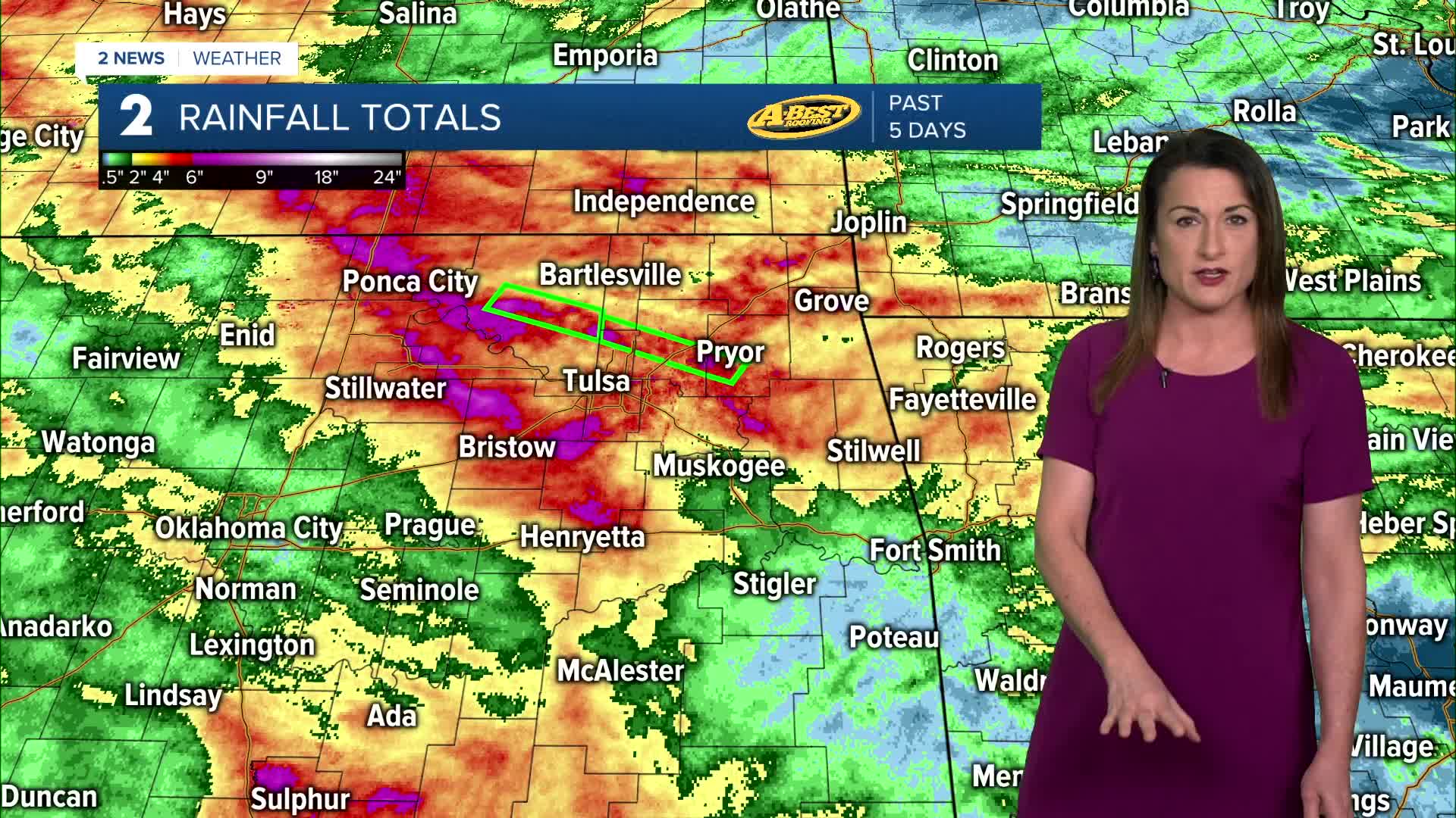


***FLASH FLOOD WATCH FOR MOST OF NE OKLAHOMA UNTIL 7 AM TOMORROW***
Showers and thunderstorms will increase late tonight and continue through Thursday, with additional rounds possible into Friday. Flash flooding remains a major concern, especially across northeast Oklahoma where the ground is already saturated from recent rain. Even a quick burst of heavy rainfall could lead to flooding issues.
Along with flooding, large hail and damaging winds will be the main severe weather threats. A low tornado risk may also develop late Thursday night into early Friday, mainly in far northeast Oklahoma into southeast Kansas.
Forecast details remain somewhat uncertain, including where the heaviest rain and strongest storms will set up. Right now, the highest chance for the most impactful weather appears to be north of Interstate 40.
Rain chances begin to taper off heading into the weekend. Saturday looks partly cloudy with highs in the low 90s, followed by mostly sunny skies and mid 90s by Sunday.
Early next week, a more typical summer pattern takes over with hot, humid weather and very low rain chances. Heat index values will likely climb into the 100s, and heat advisories may be needed.
Stay in touch with us anytime, anywhere --
- Download our free app for Apple, Android and Kindle devices.
- Sign up for daily newsletters emailed to you
- Like us on Facebook
- Follow us on Instagram
- Watch LIVE 24/7 on YouTube
