
TULSA, Okla. — A few isolated showers and storms overnight and into early Friday morning. Overnight lows in the low 60s with clouds increasing across the area.
Friday: Increasing Severe Weather Risk
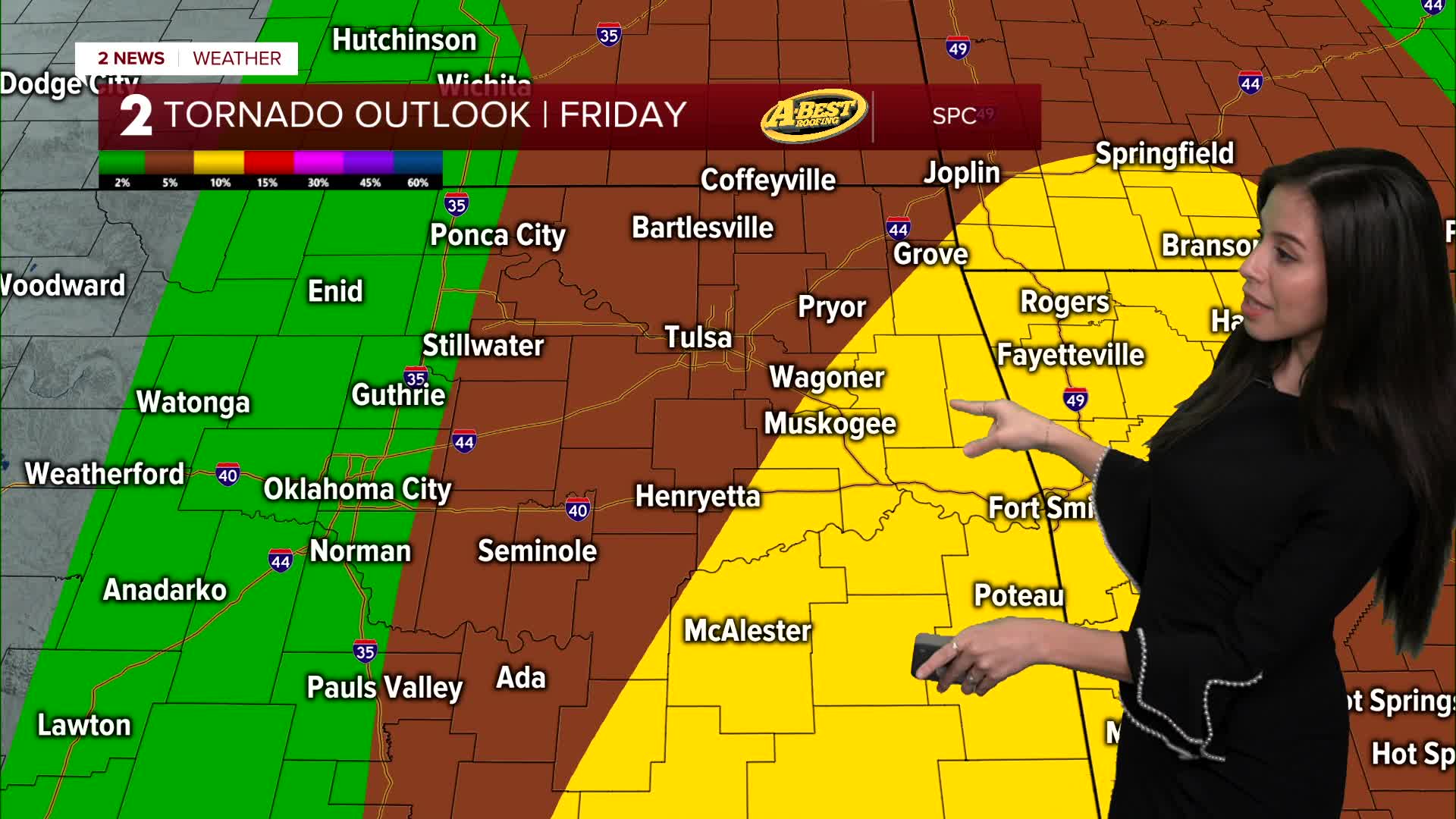
Attention turns to Friday, when another strong weather system moves into the Plains.
Storms may already be ongoing Friday morning, but the greater risk for severe weather appears to develop Friday afternoon and evening as the atmosphere becomes more unstable.
Conditions that could support stronger storms include:
- Increasing warmth and humidity
- Gusty southerly winds bringing in more moisture
- Strengthening storm development ahead of an approaching cold front
If storms redevelop as expected, hazards could include:
- Large hail
- Damaging winds
- A tornado threat
- Additional heavy rainfall
Flooding could also become a concern again if storms repeatedly move over the same areas.
Weekend Outlook
A cold front will move through Friday night into Saturday morning, bringing an end to most of the rain.
Behind the front:
- Cooler, drier air moves in
- High pressure settles over the region through Sunday
- Dry weather is expected through the weekend
Looking Ahead to Next Week
Forecast models suggest another weather system could approach by Tuesday into Wednesday, bringing another chance of rain and possibly storms.
However, the timing and strength of that system are still uncertain and will become clearer over the next few days.
Stay in touch with us anytime, anywhere --
- Download our free app for Apple, Android and Kindle devices.
- Sign up for daily newsletters emailed to you
- Like us on Facebook
- Follow us on Instagram
- Watch LIVE 24/7 on YouTube
