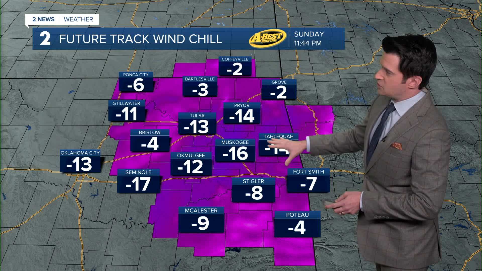


***EXTREME COLD WARNING FOR ALL OF EASTERN OKLAHOMA UNTIL NOON MONDAY***
We'll see clouds around tonight with maybe a few flurries overnight into early Monday morning. The low in Tulsa down to -1°. Wind chills 0° to -15°. Winds north 5-10 mph.
Clouds clear during the day on Monday. Highs in the mid 20s. NW winds and then shifting to SW later in the day 5-15 mph.
Partly cloudy on Tuesday with lows around 7°. Highs near 32°.
Mostly sunny on Wednesday with lows around 6° and daytime highs just above freezing.
Back to partly cloudy skies on Thursday with lows around 16° and highs near 32°.
Morning lows in the upper teens to begin Friday with highs in the mid 20s as we get another shot of frigid air.
Over the weekend, the cold air hangs around. Lows in the single digits (around 5°) Saturday and around 17° Sunday. Daytime highs on Saturday in the mid 20s and then mid 30s on Sunday.
Have a great week ahead and stay warm!
Stay in touch with us anytime, anywhere --
- Download our free app for Apple, Android and Kindle devices.
- Sign up for daily newsletters emailed to you
- Like us on Facebook
- Follow us on Instagram
- Watch LIVE 24/7 on YouTube
