

TULSA, Okla. — We'll see maybe a few showers and storms in SE Oklahoma tonight with possibly strong to severe cells. Mainly a wind and hail threat.
Otherwise, mostly everybody will be completely dry with a storm free night! Clearing skies overnight with maybe some fog developing. The low down to 67° in Tulsa. SW winds 5-10 mph.
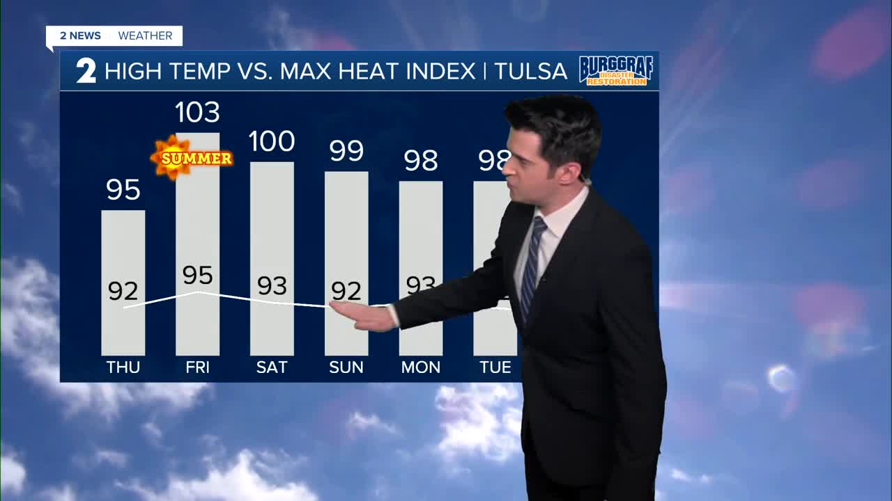
Some patchy fog early Thursday morning, otherwise mostly sunny skies. The high reaching 92°. SSE winds 5-10 mph. The heat index up to 95°.
Low 70s Friday morning, then mid 90s and mostly sunny. The heat index up to 103°. The summer solstice begins late at night.
Over the weekend, expect mostly sunny skies. Lows in the mid 70s and highs in the low to mid 90s. Breezy to windy south winds possibly gusting 30-35 mph. The heat index around 100°.
The heat continues next week with highs in the 90s. Overnight/morning lows in the 70s.
We are storm free for now. Have a great rest of your week.
Stay in touch with us anytime, anywhere --
- Download our free app for Apple, Android and Kindle devices.
- Sign up for daily newsletters emailed to you
- Like us on Facebook
- Follow us on Instagram
- Watch LIVE 24/7 on YouTube
