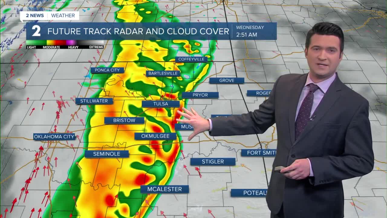


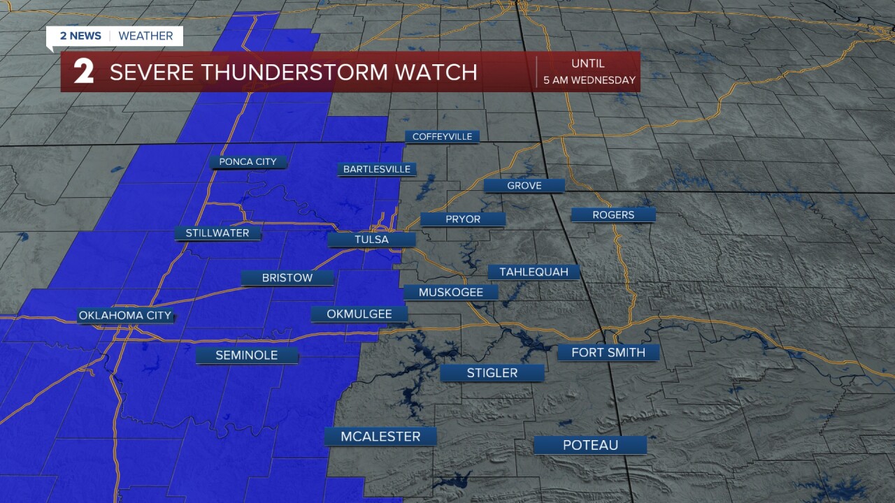
**Severe Thunderstorm Watch until 5 am for some counties in eastern Oklahoma**
We'll see increasing storms overnight. Some storms could be strong to severe, especially west of Tulsa. Lows in the low 60s. Gusts 30-35 mph out of the SE.
Showers and storms on Wednesday. Highs only in the mid 60s. Gusts up to 30 mph. Winds first SE and then NW by the evening.
More showers on Thursday. Highs near 60°. Getting windy with gusts 40-45 mph. A Wind Advisory might be needed. In total for 2 days, we could pick up 1-3" of rain in the area.
Back to dry weather on Friday, but still quite gusty. Gusts 30 mph+. Highs in the mid 60s.
Over the weekend, it will be dry and mostly sunny. Upper 60s for temperatures. Morning lows in the 40s.
Highs in the 60s on Monday and then another front comes in by Tuesday. Max temperatures on Tuesday might only be near 50° with more showers.
Stay in touch with us anytime, anywhere --
- Download our free app for Apple, Android and Kindle devices.
- Sign up for daily newsletters emailed to you
- Like us on Facebook
- Follow us on Instagram
- Follow us on Twitter
