

TULSA, Okla. — We'll have mostly cloudy skies tonight with the low in Tulsa down to 50°. ENE winds 5-15 mph.
Mostly cloudy skies Tuesday morning with maybe a few showers or sprinkles early in the morning as a weak system crosses the area. Some sunbreaks in the afternoon. The high reaching 73°. SE winds 5-15 mph.
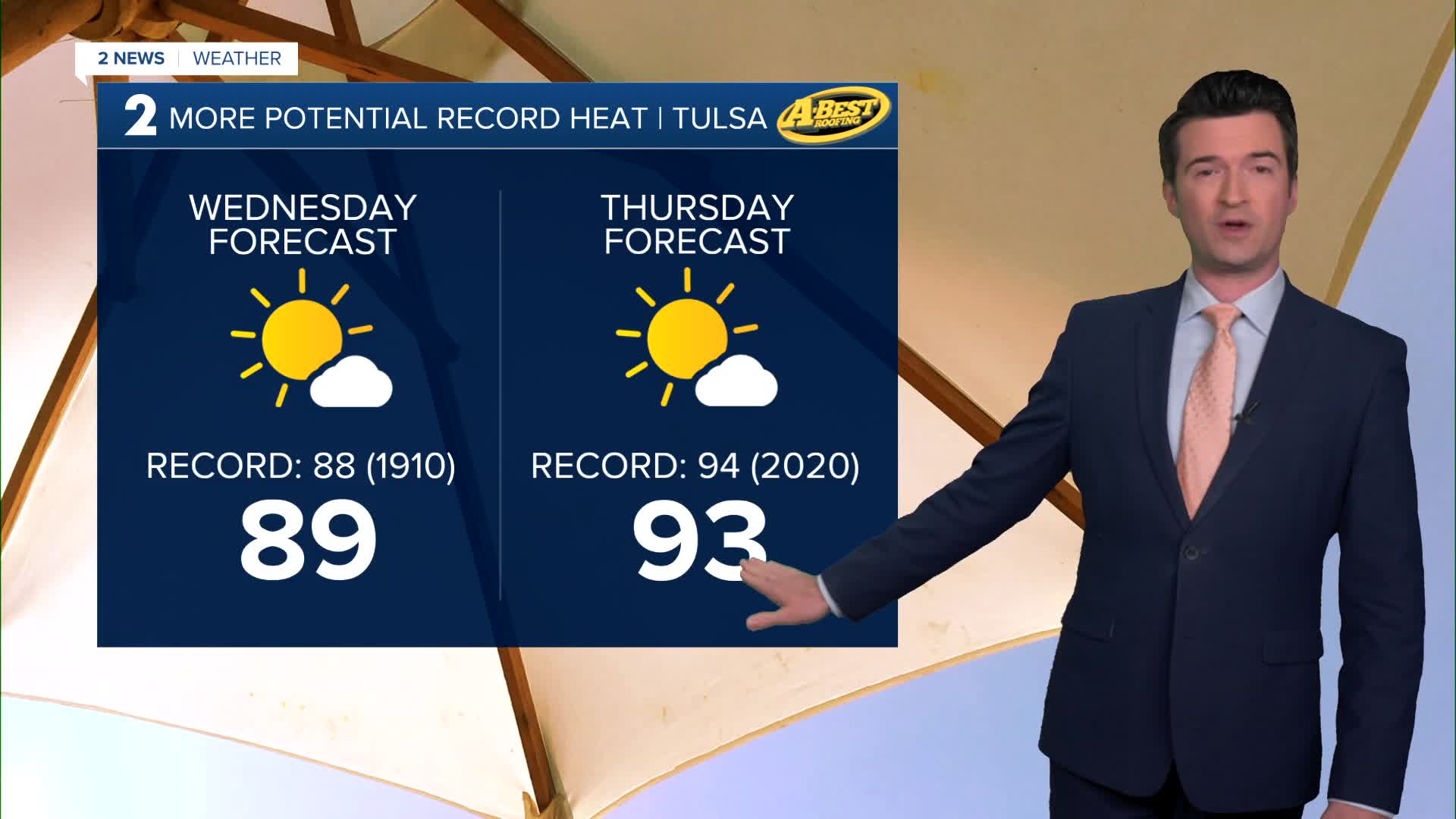
Mostly sunny on Wednesday with lows in the mid 50s and highs in the upper 80s. Going for 89° in Tulsa. The record for the date is 88° from 1910, so we could easily break that record. South winds 10-15 mph.
For Thursday, lots of sunshine and hot again. Lows in the upper 60s with highs in the low 90s. Going with 93° in Tulsa. The record for the date is 94° from 2020. South winds 15-25 mph. The fire danger looks high again.
A cold front moves through by Friday with lows in the 50s and highs in the 60s. Mostly cloudy skies with maybe a few rain showers. South winds, then north winds 15-30 mph. Still high fire danger with the strong winds and wind shift.
Over the weekend, lows in the upper 30s Saturday morning with daytime highs in the mid 60s. Partly cloudy. Then lows in the mid 40s Sunday morning with afternoon temps in the mid 70s. Mostly sunny.
Stay in touch with us anytime, anywhere --
- Download our free app for Apple, Android and Kindle devices.
- Sign up for daily newsletters emailed to you
- Like us on Facebook
- Follow us on Instagram
- Watch LIVE 24/7 on YouTube
