

TULSA, Okla. — We'll see partly cloudy, then mostly clear skies later tonight. The low in Tulsa down to 44°. North winds 15-25 mph with gusts 30-35 mph behind a dry cold front.
On Monday, partly cloudy skies with highs in the mid to upper 60s. Going for 67° in the Tulsa metro. NE winds 10-15 mph with gusts to 25 mph, especially in the morning. Calming down during the day.
Tuesday starts out in the mid 40s with highs in the low 70s. Slight chance for a few light showers in the morning. Otherwise partly cloudy and dry. SE winds 5-15 mph.
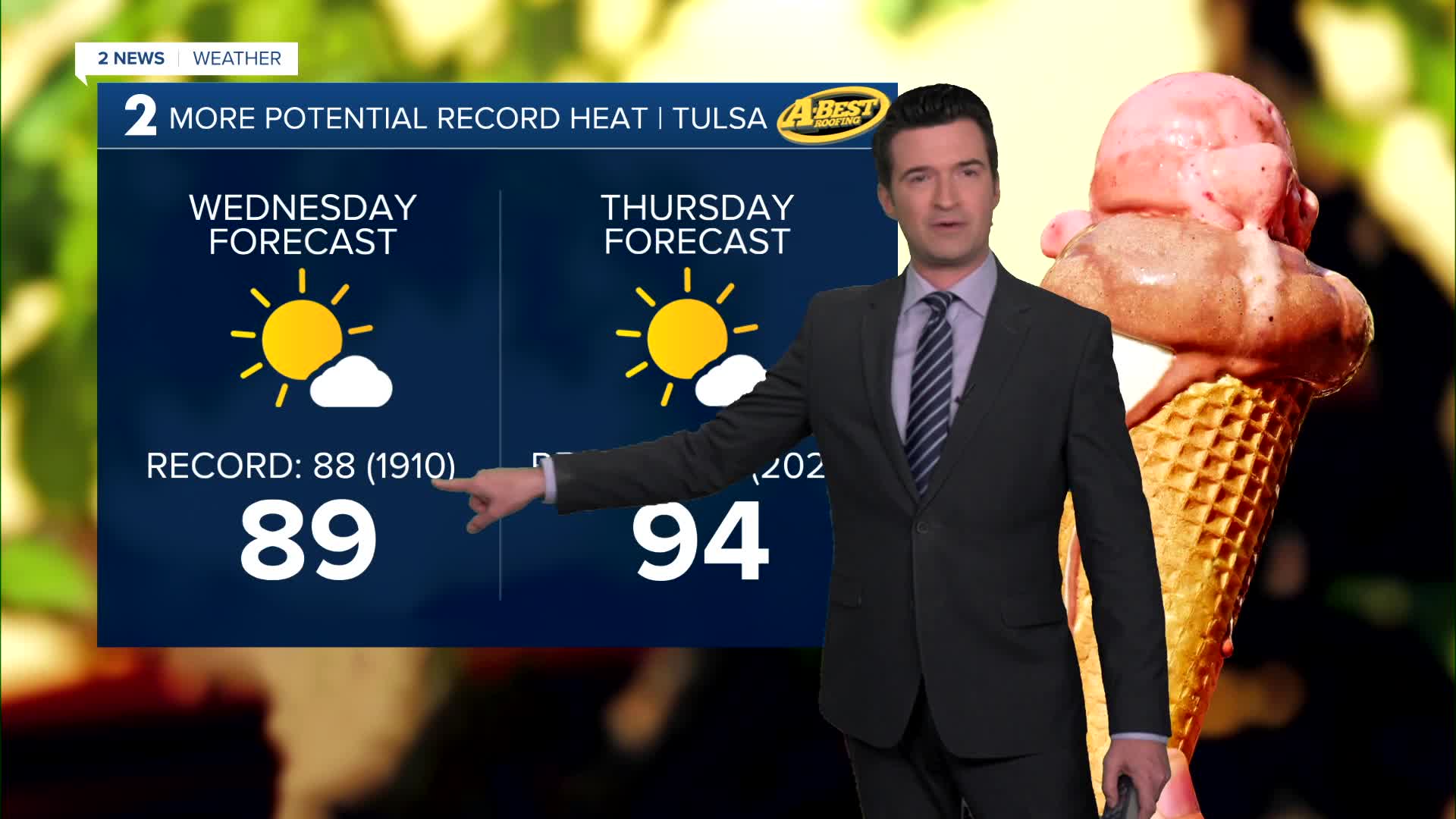
Mostly sunny on Wednesday. Lows in the mid 50s with highs around 89°. We could break the record. The record is 88° from 1910. South winds 5-15 mph.
Lows in the mid to upper 60s Thursday morning and then daytime highs around 94°. We could tie or even break the record again. The record for the date is 94° from 2020. South winds 15-25 mph. Mostly sunny.
A cold front comes in by Friday with lows in the 50s and highs in the 60s. Slight chance for a few rain showers. Partly sunny skies. South winds, then north winds 15-30 mph as the system works through the area.
Behind the front for Saturday morning, lows in the upper 30s and then afternoon highs in the upper 60s. Partly cloudy.
For Sunday, lows in the mid 40s with highs in the mid 70s. Mostly sunny.
Have a great week ahead!
Stay in touch with us anytime, anywhere --
- Download our free app for Apple, Android and Kindle devices.
- Sign up for daily newsletters emailed to you
- Like us on Facebook
- Follow us on Instagram
- Watch LIVE 24/7 on YouTube
