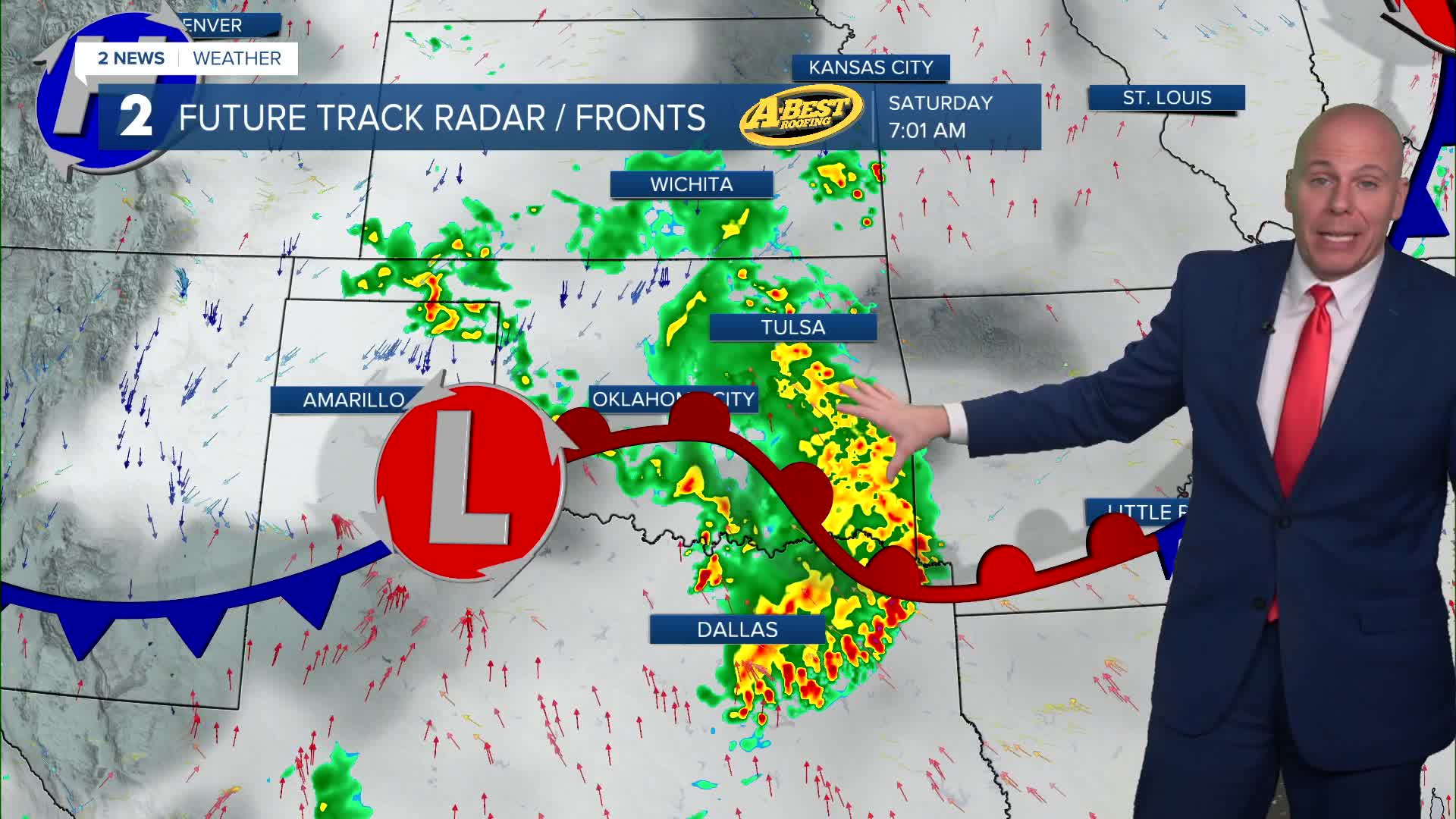


TULSA, OKLA — Another round of showers and isolated thunderstorms is expected lto increase in coverage from west to east Saturday morning as our next wave of energy aloft moves over the area. Heavy rainfall and gusty winds are the main concerns with this activity. Showers and storms will gradually taper off for the rest of the day, but we'll keep a chance of an isolated pop-up storm or two in the forecast Saturday afternoon and evening. Highs around 80°.
The focus for rainfall moves a bit further east for the rest o the holiday weekend leaving Green Country with just a slight chance of spotty to isolated showers Sunday and Memorial Day. Temperatures will trend a bit warmer with highs in the lower to mid 80s with humid conditions.
Additional chances for showers and thunderstorms are expected from Tuesday through the end of the week as upper-level troughing stays in place over the central United States. This will bring another focus for potentially heavy rainfall over Green Country midweek. The severe weather threat remains low in this window of time.
Temperatures are expected to stay close to normal for late May throughout next week.
Stay in touch with us anytime, anywhere --
- Download our free app for Apple, Android and Kindle devices.
- Sign up for daily newsletters emailed to you
- Like us on Facebook
- Follow us on Instagram
- Watch LIVE 24/7 on YouTube
