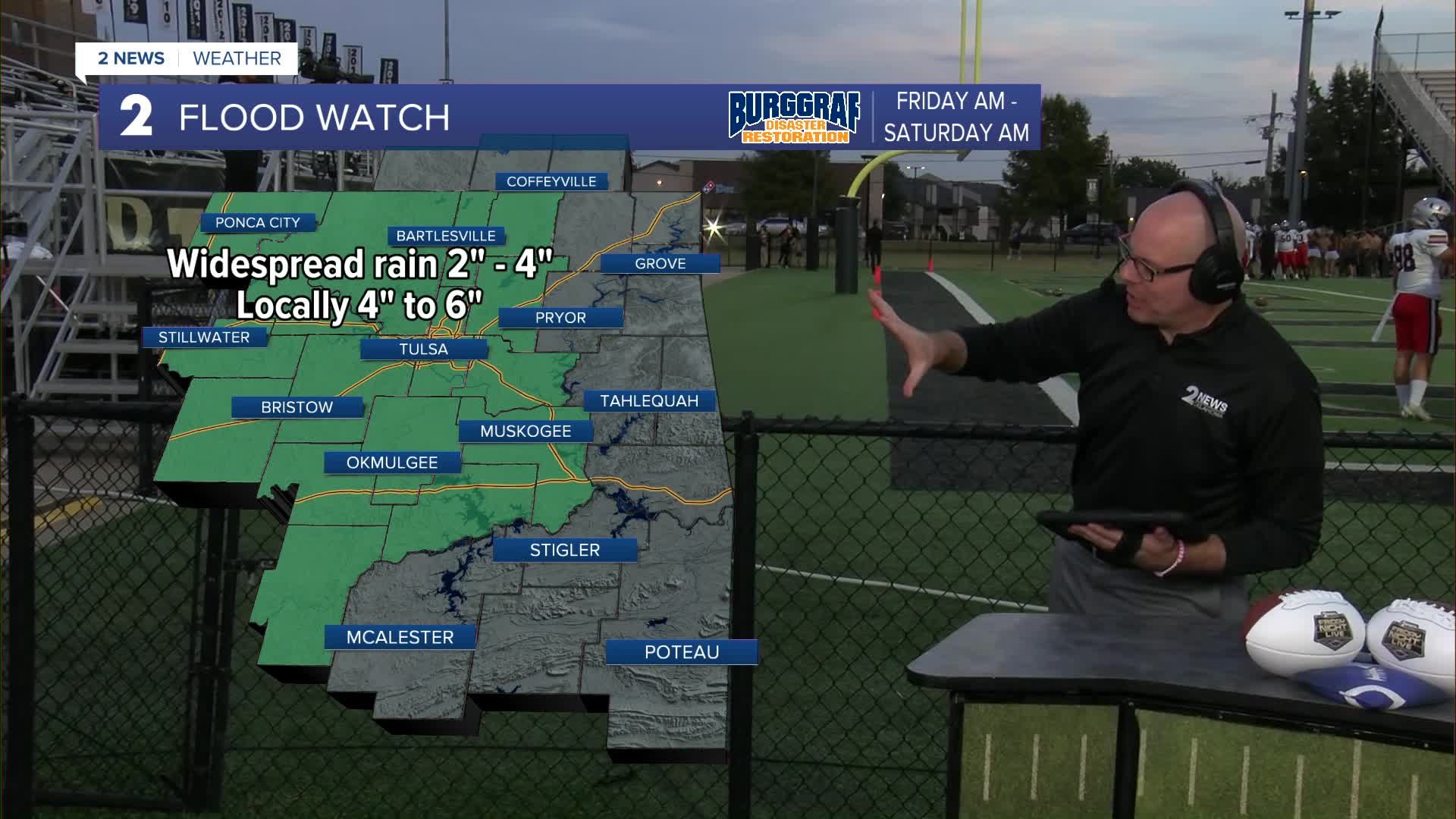


***FLOOD WATCH FOR MOST OF NORTHEAST OKLAHOMA FROM FRIDAY MORNING UNTIL SATURDAY MORNING. 2-3" WILL BE COMMON WITH LOCALLY 4-6" IN SOME SPOTS***
Look for some scattered showers and thunderstorms to move in later tonight and overnight. There could be a strong to severe cell with a wind and hail threat, mainly on the west and south side of our viewing area. Lows drop to the mid/upper 50s.
Showers and thunderstorms for your Friday with highs in the low 60s.
Rain showers continue on Saturday with lows in the mid 50s and highs in the low 60s.
Lows in the mid 50s and then daytime highs in the mid 60s on Sunday. Any leftover rain showers will be confined to the early morning hours.
Around 55° to start Monday and then mid to upper 60s. Mostly cloudy skies with a slight chance for a shower.
A cold front will then pass through with lows around 50° Tuesday morning with afternoon highs in the mid/upper 60s again. Partly cloudy to mostly sunny skies.
Lows down to the mid 40s Wednesday with highs in the low 60s and partly cloudy to mostly sunny.
Even colder Thursday morning with lows around 40° with highs returning to the low 60s. Lots of fall sunshine.
Stay in touch with us anytime, anywhere --
- Download our free app for Apple, Android and Kindle devices.
- Sign up for daily newsletters emailed to you
- Like us on Facebook
- Follow us on Instagram
- Watch LIVE 24/7 on YouTube
