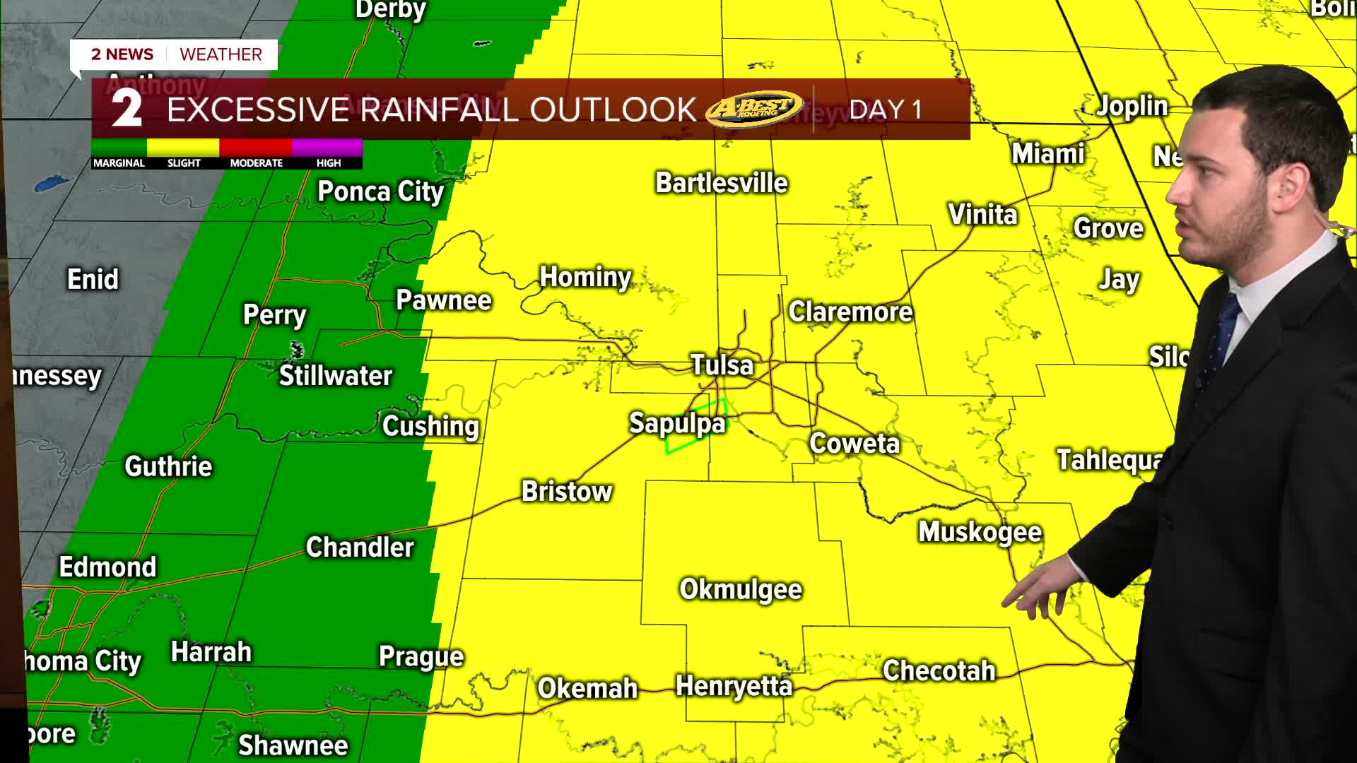


***FLOOD WATCH FOR MOST OF GREEN COUNTRY ON SUNDAY FROM 7 AM UNTIL 7 PM FOR MORE SCATTERED STORMS THAT COULD LEAD TO FLASH FLOODING IN SOME SPOTS***
Mostly cloudy skies on Sunday with more scattered showers and storms mainly in the morning but some isolated showers possible in the afternoon. Some storms could be strong to severe with mainly a wind and hail threat. Low chance for a tornado. The high in Tulsa up to 83°. South winds 10-20 mph.
For Monday, partly cloudy with the chance for a few showers and thunderstorms. Lows in the low 70s with highs in the upper 80s. South winds 15-25 mph. Starting Monday and continuing through all of the week, afternoon heat indices will be up around 105°.
Mostly sunny skies on Tuesday. Lows in the upper 70s with highs in the low 90s. South winds 10-20 mph.
Wednesday also brings us hot conditions. Morning lows in the upper 70s with highs in the low 90s. Mostly sunny. South 15-25 mph.
Partly cloudy skies on Thursday. Lows in the mid 70s with highs around 90°. Chance for a few showers and thunderstorms moving in. SSE 10-20 mph.
A sun/cloud mix on Friday with lows in the low 70s with highs in the upper 80s.
As of now, next weekend features a chance for some showers and thunderstorms. Lows around 70° with highs in the mid to upper 80s.
Stay in touch with us anytime, anywhere --
- Download our free app for Apple, Android and Kindle devices.
- Sign up for daily newsletters emailed to you
- Like us on Facebook
- Follow us on Instagram
- Watch LIVE 24/7 on YouTube
