

TULSA, OKLA — We will see an increase in clouds with a gusty south breeze this afternoon. Highs in the mid-50s.
Rain moves in this evening and will continue overnight as our next storm system moves in. Some lightning and thunder will be possible.
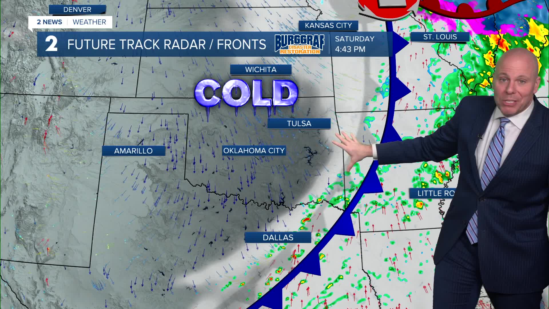
Scattered showers are expected for Saturday morning with highs reaching the low/mid-50s around midday. A cold front will dry us out Saturday afternoon and bring a swift drop in temperatures. Falling through the 40s in the afternoon and in the 30s for the evening. Wind chills in the 20s. Dress for this temperatures drop! Temperatures by Sunday morning will reach the mid-20s with wind chills in the teens.
Sunday is looking dry, partly cloudy, and cold. Highs struggle into the mid/upper 30s with a breezy north wind.
We may see a light wintry mix or light snow in the region for Monday. At this time, this isn't looking like a big storm by any means, but could be enough for some light accumulation in a few spots.
Keep in mind, uncertainty still exists to how this may play out. We'll continue to refine our forecast through the weekend as newer data comes in. Lows in the 20s with highs stuck in the 30s.
As of now, it looks like we'll be back to dry weather on Tuesday with lows in the 20s and highs in the 40s. 50s for highs are back for Wednesday.
Stay in touch with us anytime, anywhere --
- Download our free app for Apple, Android and Kindle devices.
- Sign up for daily newsletters emailed to you
- Like us on Facebook
- Follow us on Instagram
- Watch LIVE 24/7 on YouTube
