

TULSA, Okla. — We'll have clear skies tonight with the low in Tulsa down to 56°. South winds 5-15 mph.
A disturbance will cross through southeast Oklahoma early Monday morning. It could generate a few showers and t-storms southeast of Tulsa. Otherwise, mostly sunny with the high up to 86°. The record for the date is 88° from 1911. We'll be close. SSW winds 10-20 mph with gusts up to 30 mph.
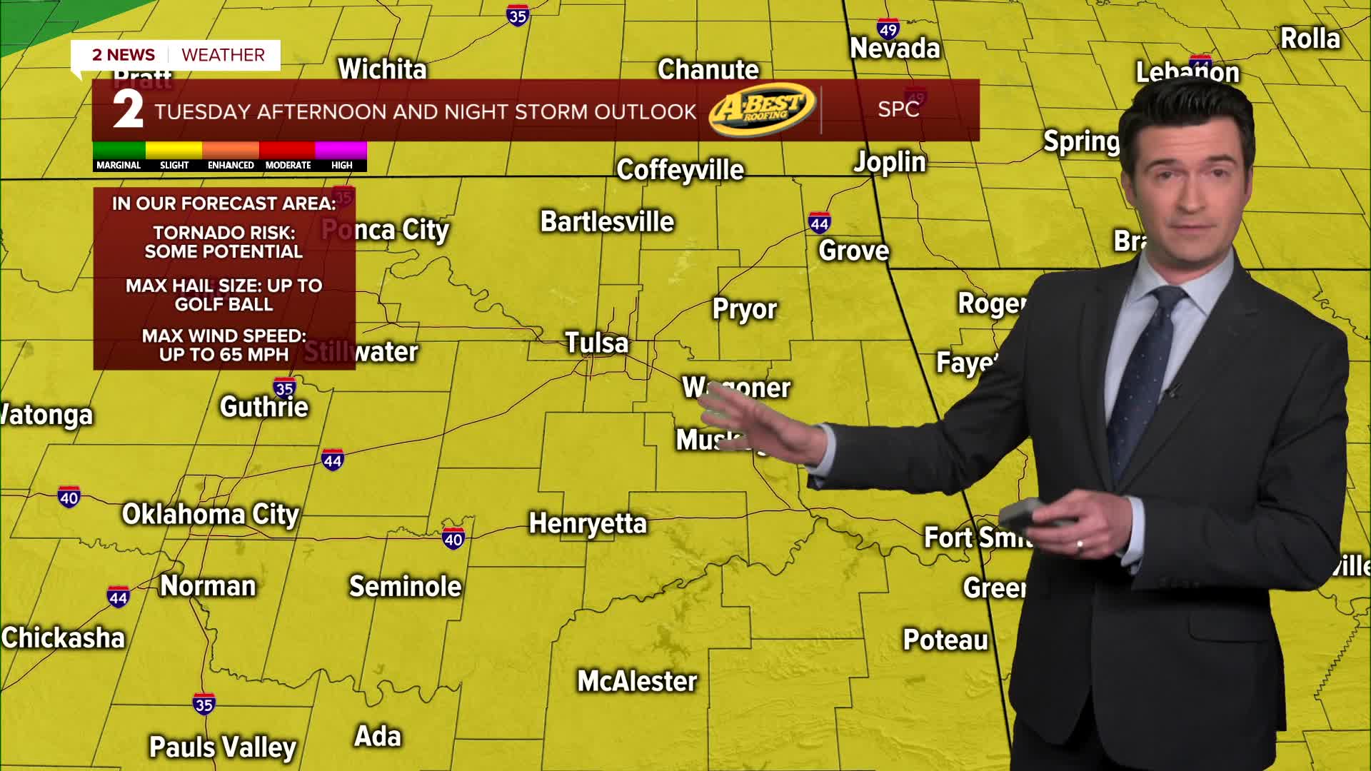
Increasing clouds on Tuesday becoming mostly cloudy. Lows mild to start the day in the mid to upper 60s. Chance for some showers and storms developing in the afternoon, but more likely by evening and stretching into the late night hours. All modes of severe weather possible with a wind, hail, and limited tornado threat. Highs in the low 80s. South winds 10-20 mph.
A cold front will cross the area early Wednesday. Some scattered showers and maybe some t-storms in the morning. Lows in the mid 50s with highs in the mid 60s. South winds and then north winds behind the front 15-25 mph. Clearing is forecast during the afternoon with some sunshine possible.
Mostly sunny skies on Thursday and Friday. We could have a light freeze in spots Thursday morning. We are forecasting 36° in Tulsa. Highs in the mid 60s. Then on Friday, lows in the mid to upper 40s with highs in the mid 70s.
Then for Saturday, look for mostly sunny skies. Lows in the upper 40s with daytime highs in the upper 70s to around 80°.
Lows Sunday in the mid 50s with highs in the mid to upper 70s.
Our next cold front is scheduled to arrive either later Sunday or on Monday. As of now, going for lows in the 30s Monday and highs in the 50s.
Have a great week ahead!
Stay in touch with us anytime, anywhere --
- Download our free app for Apple, Android and Kindle devices.
- Sign up for daily newsletters emailed to you
- Like us on Facebook
- Follow us on Instagram
- Watch LIVE 24/7 on YouTube
