

TULSA, OKLA. — We'll have mostly cloudy skies tonight with only a slim chance for a shower or two. South winds 10-15 mph with the low in Tulsa down to 65°.
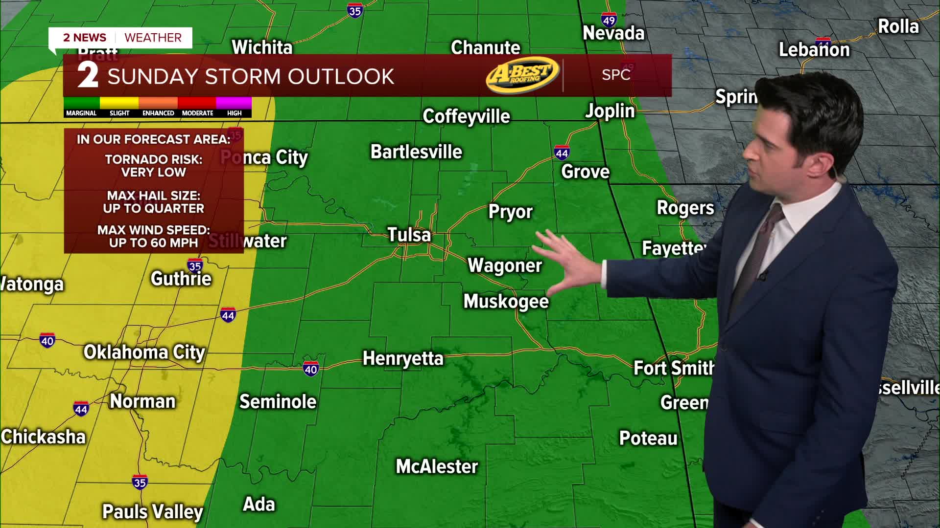
Mostly cloudy on Sunday with scattered showers and t-storms moving in during the morning. It looks like we'll have some showers and storms in the afternoon to early evening as well. During the afternoon to early evening will have the best chance for a severe storm or two, with mainly a wind and hail threat. South winds 15-20 mph with gusts up to 30 mph. The high up to 75°.
Fairly cloudy with some sunbreaks on Monday with lows in the upper 60s and highs in the mid 80s. South winds 15-25 mph. The chance for storms looks pretty low, but it something were to develop, it would become severe fast with mainly a wind and hail threat.
The severe threat goes up on Tuesday and Wednesday, with all modes of severe weather possible. Lows in the mid to upper 60s and highs from the upper 70s to low 80s. Stay tuned as we continue to refine the forecasts for these two days.
It looks pretty quiet on Thursday with lows in the low 60s and highs in the mid 80s.
More active weather is forecast to move in on Friday and Saturday as a cold front pushes through the region. Showers and thunderstorms are back. Highs should be around 80° on Friday and then around 70° Saturday and Sunday behind the front.
Stay in touch with us anytime, anywhere --
- Download our free app for Apple, Android and Kindle devices.
- Sign up for daily newsletters emailed to you
- Like us on Facebook
- Follow us on Instagram
- Watch LIVE 24/7 on YouTube
