

***WIND ADVISORY MONDAY 9 AM UNTIL 9 PM FOR PORTIONS OF EASTERN OKLAHOMA. SOUTH GUSTS UP TO 40-45 MPH***
TONIGHT (SUNDAY): A very isolated chance for a shower or thunderstorm in Green Country. Some showers are forming around the dryline in far western Oklahoma. Not likely to reach our area. Plan on gusty south winds to continue up to 30-35 mph. The low drops to only 75°.
MONDAY AFTERNOON TO EARLY EVENING: A few showers and thunderstorms could form across eastern Oklahoma. The chance is pretty low. Strong south winds to continue with gusts up to 40-45 mph. The high up to 88° and continued muggy.
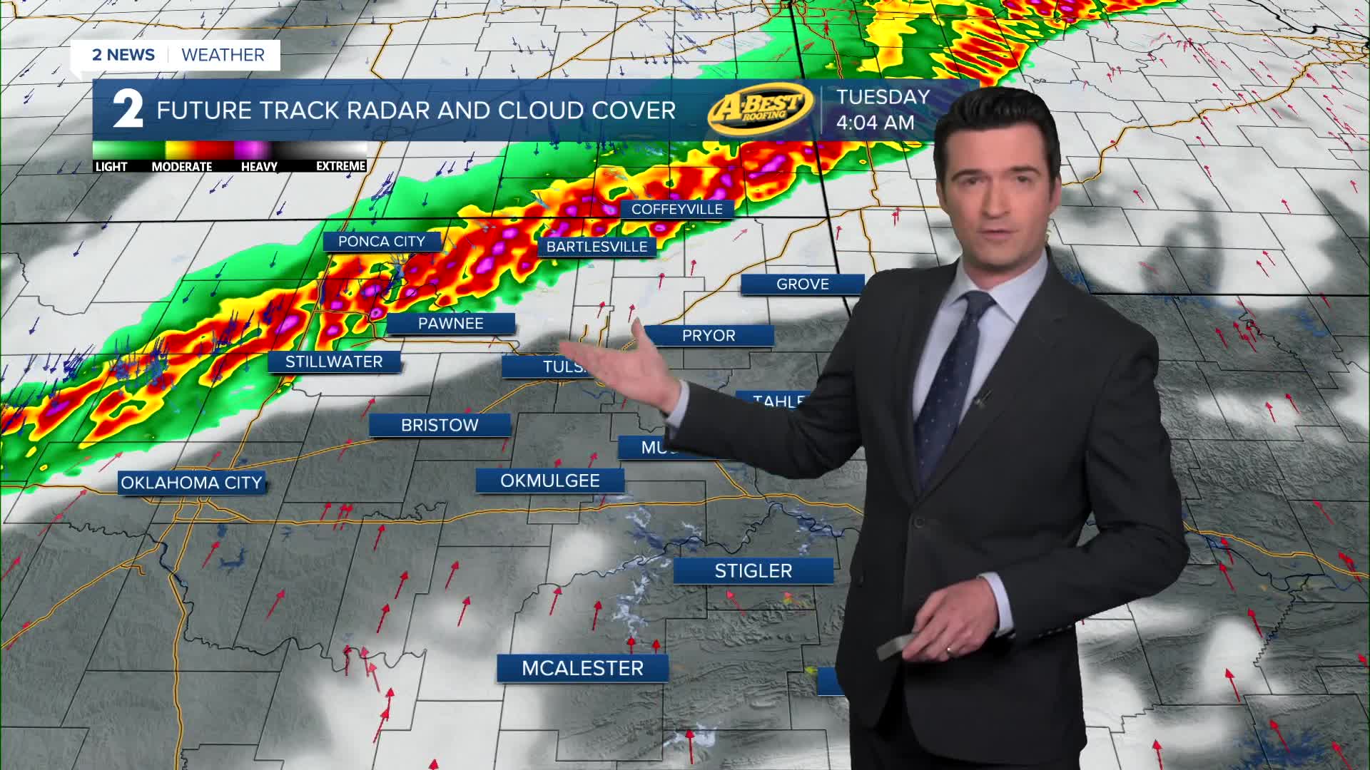
MONDAY LATE NIGHT/OVERNIGHT: A cold front will come into our forecast area from the northwest and move southeast through Tuesday. This will be our highest chance for some strong to severe storms. We expect a line of showers and storms. The greatest threat with the line would be damaging winds with a low risk for a quick forming tornado or two on the leading edge of the squall line. **Make sure to not have your phones silenced very late Monday night and overnight into early Tuesday morning**
TUESDAY MORNING THROUGH AFTERNOON: Ongoing showers and storms with possibly still some strong to severe cells. Depending on how fast the cold front moves through will determine if any strong to severe storms hang with us in far southeast Oklahoma during the afternoon hours. If the front pushes through fast, there won't be any severe chance during the afternoon in far southeast Oklahoma. Lets hope for a quick FROPA or frontal passage in Green Country. Temperatures will be in the 70s early in the morning, then drop to the 60s behind the front. North winds 10-20 mph.
WEDNESDAY THROUGH FRIDAY: Mostly cloudy with the chance for scattered showers and t-storms. Lows in the upper 50s to low 60s. Highs in the 70s with the warmest day on Friday closer to 80°.
MEMORIAL DAY WEEKEND: Partly to mostly cloudy with a slight chance for some showers and storms. The chance is looking low at this time, however, it's a week away. Stay tuned to future forecasts. Lows in the 60s with afternoon highs in the low to the mid 80s.
Have a great week ahead!
