

TULSA, OKLA — The severe threat for tonight south of I-40 has ended for those of you in Pittsburg and Latimer Counties. A stray shower or storm can't be ruled out, but most of us will remain quiet through daybreak Saturday.
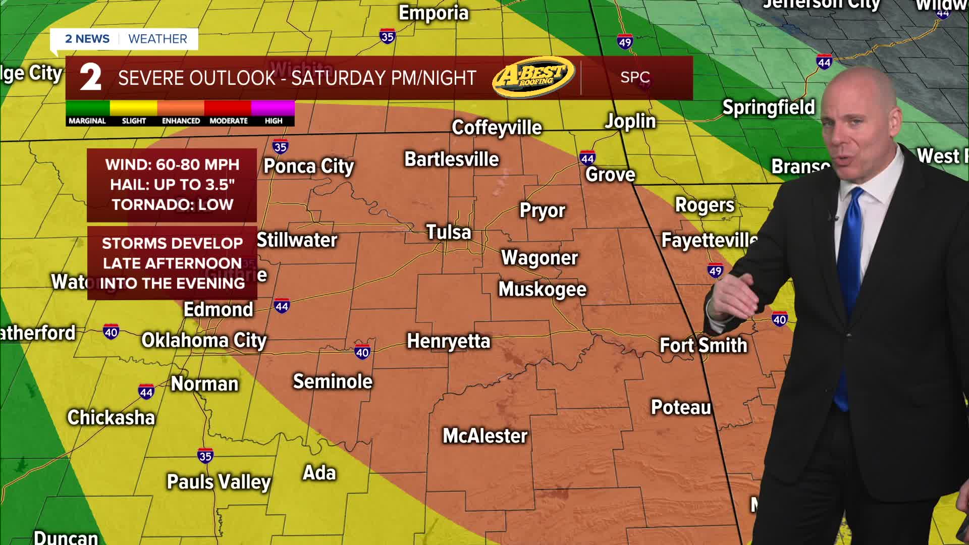
The active weather pattern continues Saturday as the boundary lifts back northward as a warm front. Scattered thunderstorms are expected to redevelop by mid-afternoon, with supercells again possible. Severe weather hazards will remain similar, including very large hail, damaging winds, and tornadoes. Afternoon highs Saturday will likely range from mid 70s to low 80s..
Sunday brings more of the same as the front lifts farther north into Kansas, placing the entire region in a warm and humid air mass. Storm coverage may be more isolated due to a capping inversion, but any storm that forms could become severe quickly. Temperatures Sunday in the upper 70s to low 80s.
There is still a chance areas east of HWY 69 get a few storms on Monday as the system exits to the east, but overall most of us will get a break from the storms with a warm day. Highs well into the 80s Monday afternoon.
Monday night into Tuesday looks quieter, with cooler temperatures settling in. Morning lows will dip into the upper 40s to low 50s, with afternoon highs in the 70s. Data differs on our rain chances by the middle of next week, but we'll keep a slight chance in the forecast. Severe weather doesn't look to be as much of a concern, but we will continue to monitor into next week.
Until then, remain weather aware through the weekend and be prepared for the potential for severe storms, especially during the afternoon and evening hours.
Stay in touch with us anytime, anywhere --
- Download our free app for Apple, Android and Kindle devices.
- Sign up for daily newsletters emailed to you
- Like us on Facebook
- Follow us on Instagram
- Watch LIVE 24/7 on YouTube
