

TULSA, Okla. — We'll see clearing skies this evening. The low down to 66°. SSE winds 5-10 mph.
Mostly sunny on Monday and reaching 89°. South winds 10-15 mph with gusts up to around 25 mph.
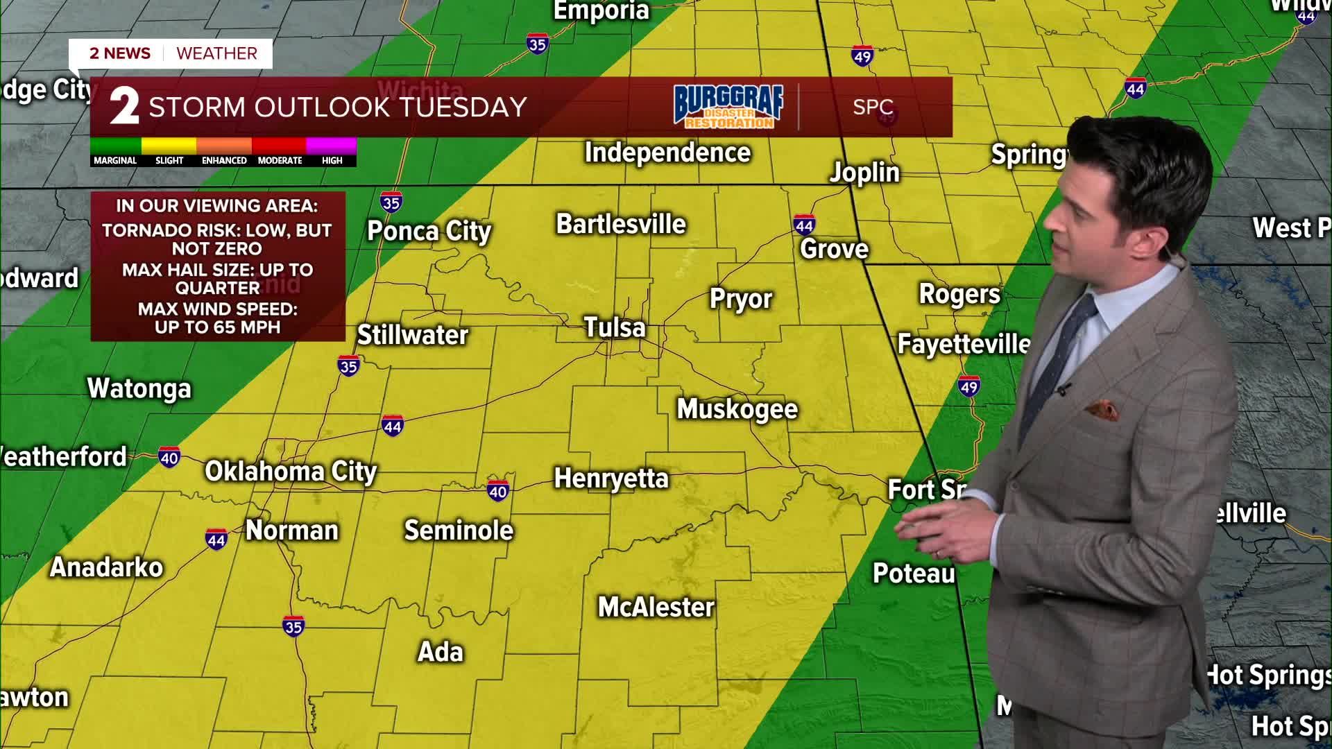
Then a chance for some scattered showers and thunderstorms increasing around midnight and into early Tuesday morning. Some ongoing showers Tuesday morning, then a break. Highs in the low to the mid 80s. SSW winds 15-25 mph. More showers and storms will fire up during the afternoon and night as a strong cold front approaches. This activity could be strong to severe with mainly a wind and hail threat. The tornado threat is there, but it's low at this time.
On Wednesday, mostly cloudy skies with a slim chance of more scattered showers and storms, but it looks fairly dry at this time. Lows in the low 60s and then highs in the mid 70s.
Thursday and Friday the showers and thunderstorms will pick back up again. Lows in the 60s and then afternoon highs in the lower 80s. If the clouds are thick enough, highs might stay in the upper 70s.
Over the weekend, more scattered showers and storms. Lows in the 60s with highs in the 80s.
When all is said and done, between Tuesday 6/3 and Sunday 6/8, we could pick up 3-8" of rain across the forecast area.
Stay in touch with us anytime, anywhere --
- Download our free app for Apple, Android and Kindle devices.
- Sign up for daily newsletters emailed to you
- Like us on Facebook
- Follow us on Instagram
- Watch LIVE 24/7 on YouTube
