

**WIND ADVISORY FOR MUCH OF NORTHEAST OKLAHOMA 6 AM TO 9 PM SUNDAY**
Today we recorded the warmest December high temperature ever! The high was 86° at the Tulsa International Airport. Temperature records go back to 1905.
We'll have mostly cloudy skies tonight with south winds 15-20 mph and gusts 20-30 mph. Temperatures will stay in the 60s overnight into much of the morning hours.
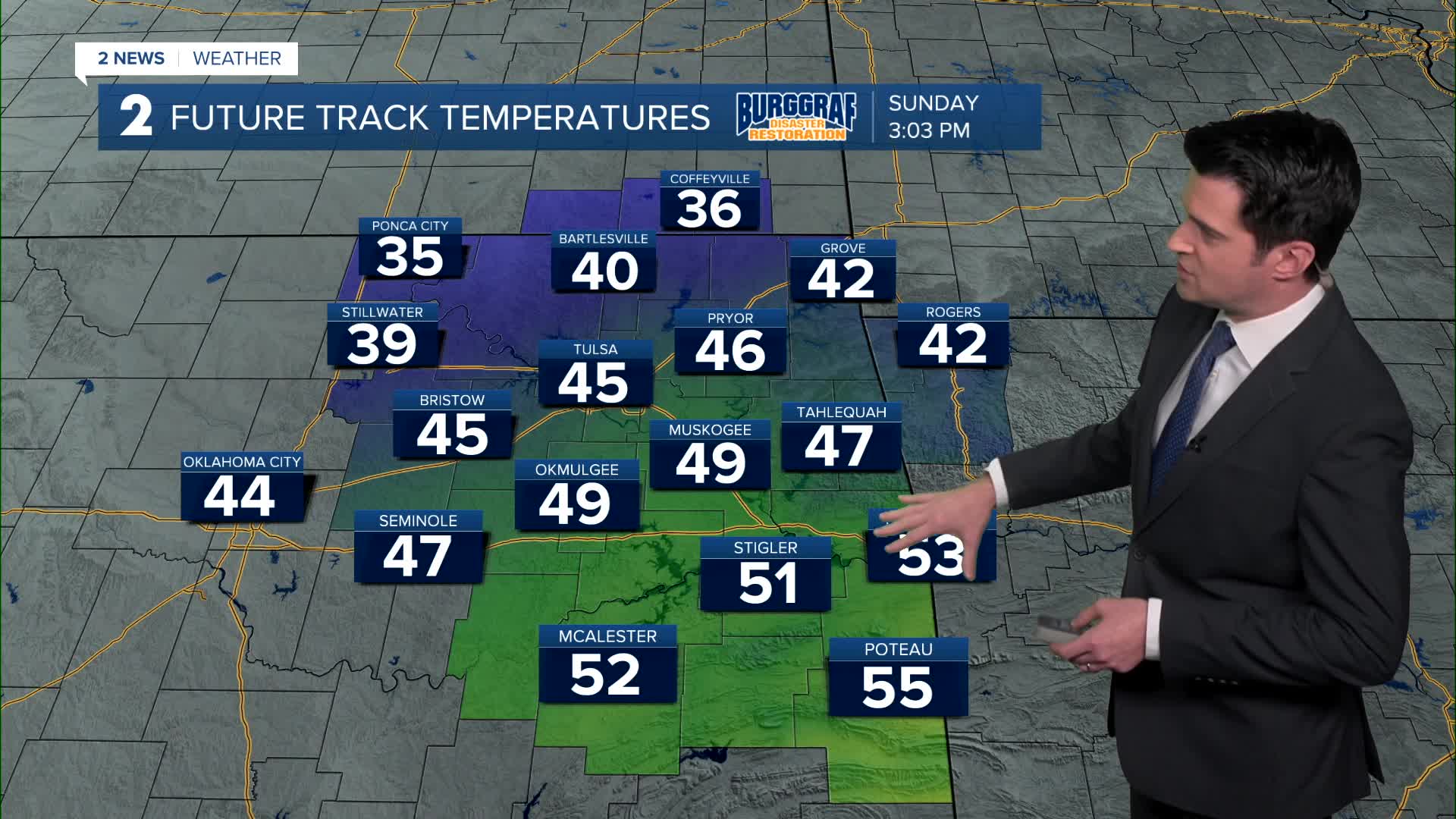
A strong cold front is on the way during the day on Sunday with dropping temperatures and gusty winds. Temperatures should be around 40° in Tulsa between 4 and 6 pm on the back side of front. Southwest winds then northwest winds 15-30 mph with gusts 40-45 mph. Chance for a few rain showers, but mainly southeast of the Tulsa area.
Starting out in the low 20s Monday morning with wind chills in the single digits and teens. Mostly sunny with a high of only 37°. Northwest winds 10-20 mph.
Lows around 20° Tuesday morning with highs in the upper 40s. Mostly sunny and lighter winds.
Mostly sunny on Wednesday to close out 2025. Lows around 30° with highs in the mid 50s.
For the start of 2026, lows in the mid 30s with highs in the 50s. Mostly sunny skies.
Temperatures could continue to warm into the low 60s for next weekend.
Stay in touch with us anytime, anywhere --
- Download our free app for Apple, Android and Kindle devices.
- Sign up for daily newsletters emailed to you
- Like us on Facebook
- Follow us on Instagram
- Watch LIVE 24/7 on YouTube
