

TULSA, OKLA. — High clouds in our forecast tonight and overnight. The low in Tulsa down to 35°. NE winds 10-15 with gusts 20-25 mph.
Mostly sunny on Sunday with the high in Tulsa reaching 58°. NE winds, then a wind shift to out of the SE 5-15 mph.
Morning clouds on Monday and then afternoon clearing. Lows down to the upper 40s with highs in the upper 60s.
Partly cloudy on Tuesday with lows in the mid 50s with highs in the mid 70s. We are going for 75°. The record for the date is 73° from 1982. So we could tie or break that record.
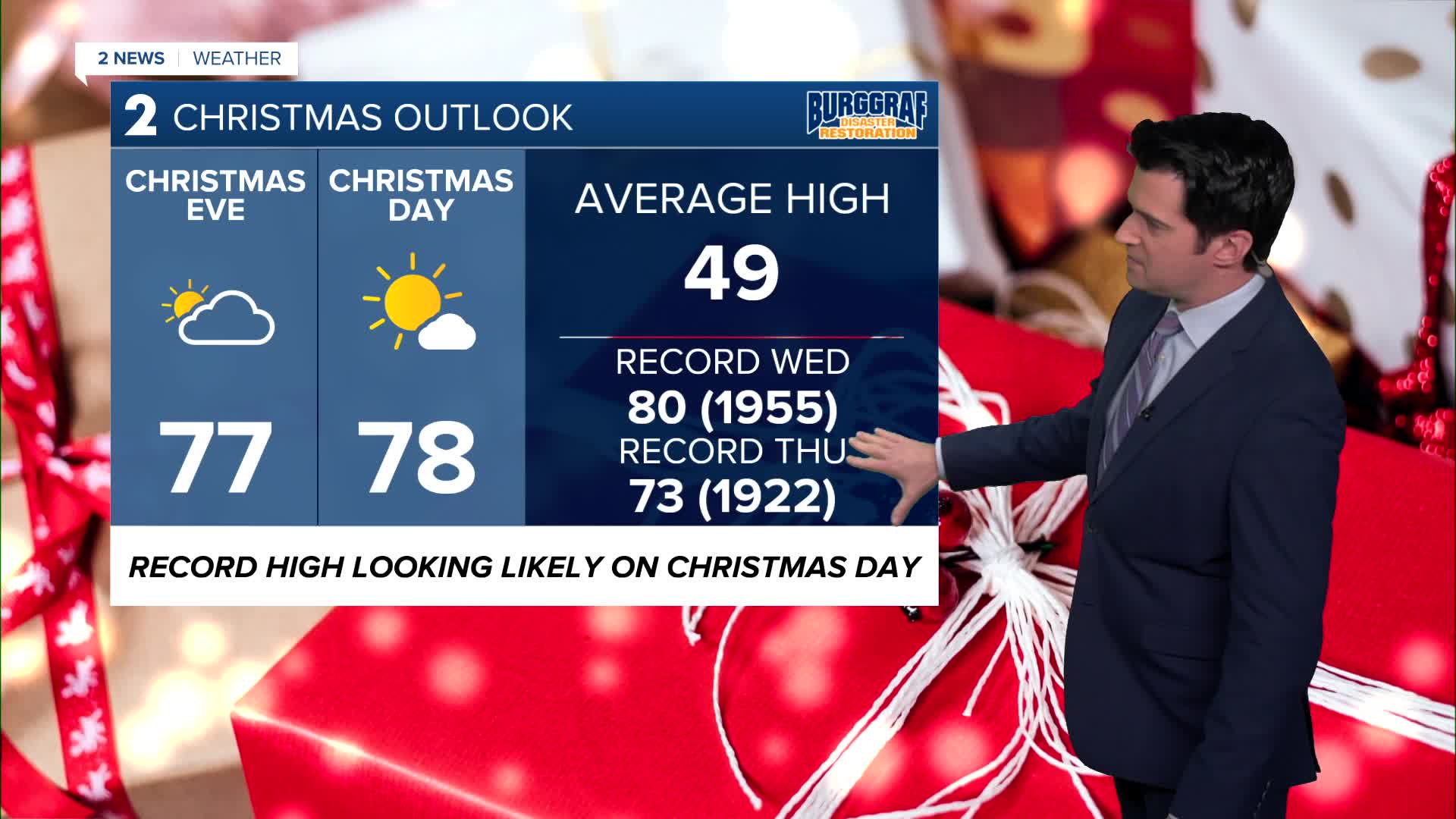
For Christmas Eve, a lot of clouds moving through with lows in the upper 50s with highs mid to upper 70s. We are going for 77°. The record for the date is 80° from 1955. That old record might stay safe. Breezy south winds.
Then on Christmas Day, we could easily break the old record of 73° from 1922. Lows in the low 60s with the forecast high at 78°. Mostly sunny skies. Breezy SSW winds.
Stay tuned as we continue to refine these warm temperatures. Have a great weekend and holiday!
Stay in touch with us anytime, anywhere --
- Download our free app for Apple, Android and Kindle devices.
- Sign up for daily newsletters emailed to you
- Like us on Facebook
- Follow us on Instagram
- Watch LIVE 24/7 on YouTube
