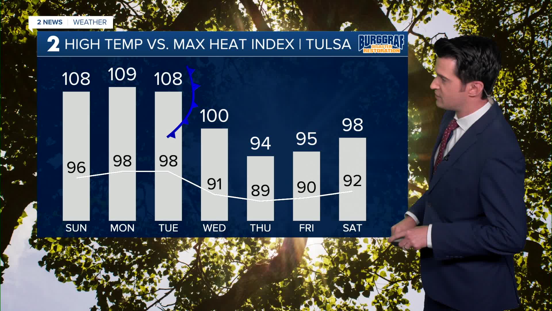


*** HEAT ADVISORY SUNDAY FROM NOON TO 8 PM. HEAT INDICES UP TO 109° ***
We'll see mostly clear skies early this evening, then some increasing clouds tonight and overnight in from the west. The low down to 78°. South winds 5-10 mph.
A sun/cloud mix on Sunday with the high up to 96° in Tulsa. South winds 5-15 mph. Heat index up to 108°. A slight chance for a shower or t-storm in the afternoon to early evening hours.
Monday brings us partly cloudy skies. Lows in the upper 70s and highs in the upper 90s. Slight chance for an afternoon/early evening shower or t-storm. Heat index up to 109°.
Partly cloudy skies on Tuesday with morning temps in the upper 70s and afternoon highs upper 90s. Heat index up to 108°. Chance for a few showers and t-storms in the afternoon, but a more widespread chance at night and overnight as a front comes down from the north. As of now, we are not expecting severe weather, but we'll keep you posted.
On Wednesday behind the front, partly cloudy with maybe a few more showers and t-storms. Lows in the lower 70s and highs in the low 90s. Heat index up to 100°.
Thursday and Friday look for mostly sunny skies. Lows from the upper 60s and into the low 70s. Highs near 90°. Heat index in the mid 90s.
Next weekend, we are expecting sunshine with some passing clouds. Lows around 70° and highs in the low 90s.
Stay in touch with us anytime, anywhere --
- Download our free app for Apple, Android and Kindle devices.
- Sign up for daily newsletters emailed to you
- Like us on Facebook
- Follow us on Instagram
- Watch LIVE 24/7 on YouTube
