

***HEAT ADVISORY FOR MUCH OF NORTHEAST OKLAHOMA SUNDAY 1 PM UNTIL 7 PM. HEAT INDEX VALUES UP TO 108° POSSIBLE!***
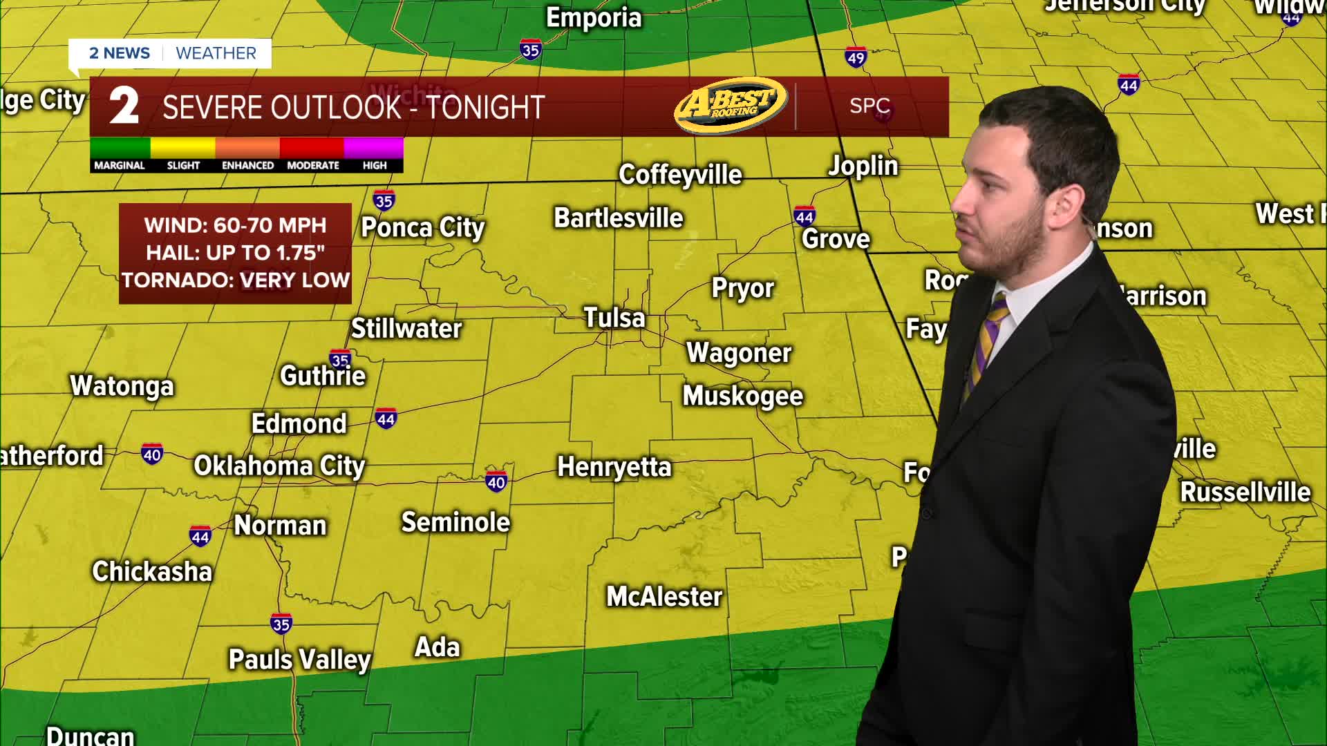
Sunday brings us the first day of summer and Father's Day. Summer officially starts at 3:24am. Storms and showers will bring scattered rain for those north of I-44. This will start to move out by lunchtime. Expect partly cloudy skies to sunny during the afternoon. Winds out of the south with some gust up to 35mph, highs in the low 90s, and heat index values up to 108° in some spots. The risk for storms will go up later Sunday night and overnight as a front moves in from the north. Our area is under a slight risk or level 2 threat of severe weather for today. Main threats will be wind, hail, and flash flooding with a lower end tornado threat.
The front will still be in the area on Monday, so still a risk for strong to severe storms during the day with a wind, hail, and flash flooding threat. Mostly cloudy skies with lows in the low 70s with highs in the mid 80s in Tulsa.
On Tuesday, still mostly cloudy and a chance for some showers and storms. Lows near 70° with highs in the mid 80s.
The unsettled pattern continues on Wednesday with the risk for more showers and storms. Morning lows near 70° with afternoon temps in the low 80s.
Thursday is looking mostly cloudy with a lower chance for showers and storms. Lows around 70 with highs in the mid 80s.
On Friday, partly cloudy with a slight chance for showers and t-storms. Lows in the low 70s with warmer highs in the upper 80s.
Over next weekend, slight chance for some showers on Saturday, but possibly dry on Sunday. Morning temps over the weekend in the mid 70s with highs in the low 90s.
Stay in touch with us anytime, anywhere --
- Download our free app for Apple, Android and Kindle devices.
- Sign up for daily newsletters emailed to you
- Like us on Facebook
- Follow us on Instagram
- Watch LIVE 24/7 on YouTube
