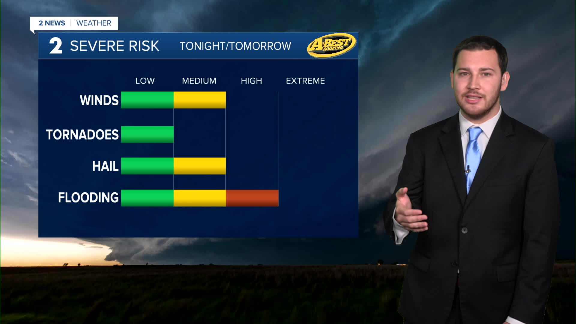


A hot and muggy day is expected Saturday with a moderate southerly breeze. Highs will be in the lower 90s with a heat index topping the century mark by the afternoon. Expect generally dry conditions through mid-afternoon with just a slight chance of showers and storms in. By late in the day, t-storms are likely developing north of the area in Kansas and will arrive later in the evening with a threat for locally strong winds and some hail. The threat of severe weather will diminish overnight and with southward extent of the storms heading into Sunday morning
Heavy rainfall Saturday night into Sunday may lead to more areas of flooding. Widespread 1" to 4" rainfall amounts are possible over the weekend. Avoid rising tributaries and driving through flooded roadways. A few spotty showers and storms may remain possible on Sunday. Lingering cloud cover and a northerly breeze will keep temperatures unseasonably mild with highs in the upper 70s.
A pleasant start to next week is expected with rain chances ending south of Tulsa by Monday morning and mild air in place. Temperatures will range from the lower 60s at night to the upper 70s during the day.
Summer heat and humidity return by midweek with the next chance of rain arriving in the second half of next week.
Stay in touch with us anytime, anywhere --
- Download our free app for Apple, Android and Kindle devices.
- Sign up for daily newsletters emailed to you
- Like us on Facebook
- Follow us on Instagram
- Watch LIVE 24/7 on YouTube
