

*** A HEAT ADVISORY IS IN EFFECT ACROSS EASTERN OKLAHOMA ON MONDAY: NOON - 8 PM ***
Partly to mostly cloudy skies tonight with the low in Tulsa only down to 80°. South winds 5-10 mph.
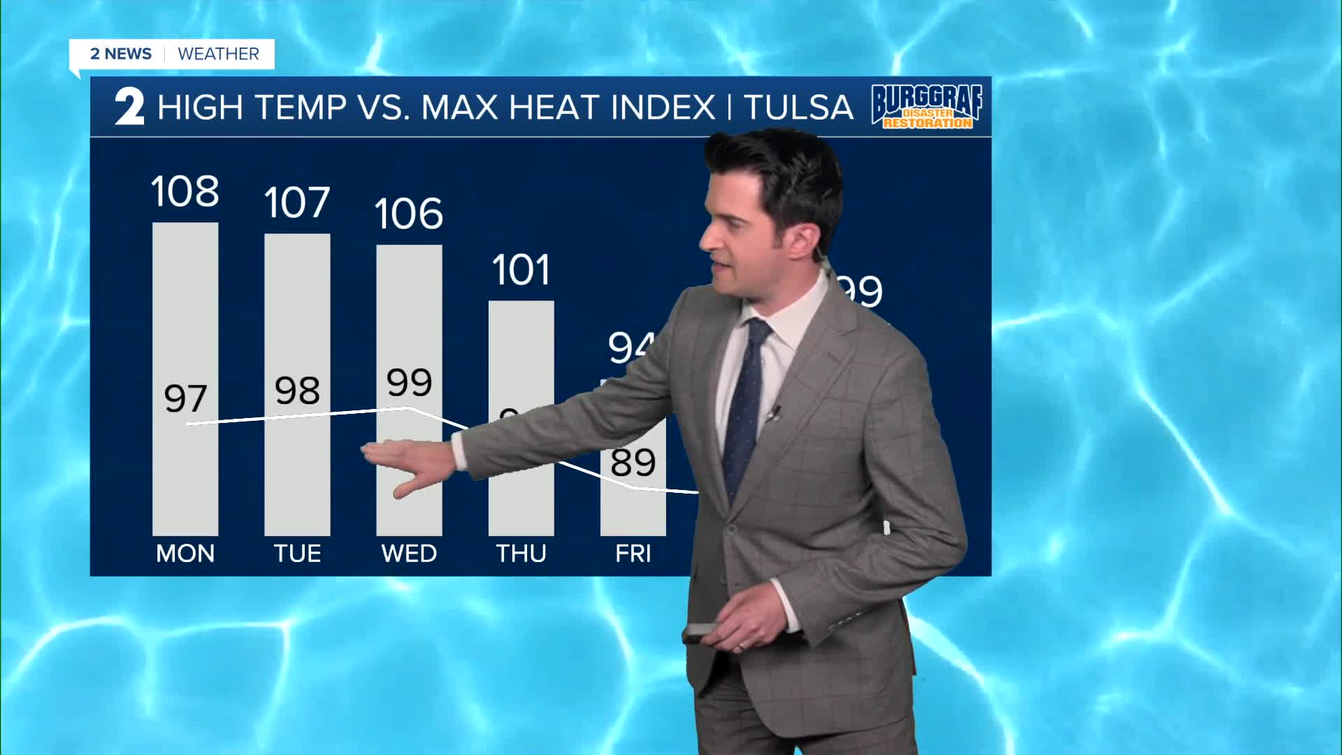
Partly cloudy on Monday with the high up to 97°. Heat index up to 108°. SW winds 5-15 mph.
We could have the hottest temperatures of the summer so far coming up for Tuesday and Wednesday. The high on Tuesday reaching 98° and 99° on Wednesday. Heat index up to 107°. Mostly sunny skies. Morning lows in the upper 70s.
Partly cloudy on Thursday with a 20% chance of a few showers and thunderstorms. Lows in the mid 70s and highs in the mid 90s. Heat index up to 101°.
On Friday, mostly cloudy skies with a 30% chance of scattered showers and t-storms. Lows in the low to mid 70s and highs in the upper 80s. Finally some relief.
Over the weekend, it looks like still a 30% chance of some showers on Saturday and then dry on Sunday. Lows in the lower 70s with highs in the upper 80s on Saturday and then near 90° on Sunday.
Have a great week ahead!
Stay in touch with us anytime, anywhere --
- Download our free app for Apple, Android and Kindle devices.
- Sign up for daily newsletters emailed to you
- Like us on Facebook
- Follow us on Instagram
- Watch LIVE 24/7 on YouTube
