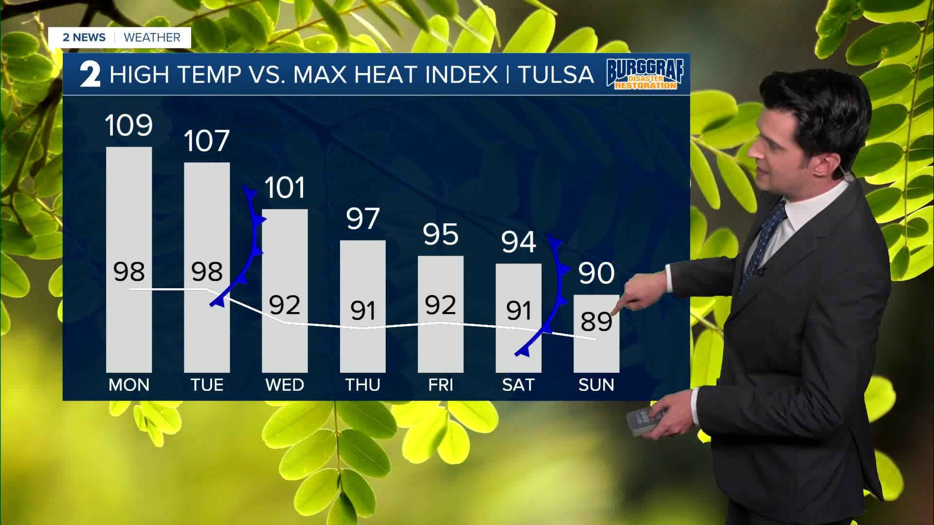


*** ANOTHER HEAT ADVISORY FOR MONDAY NOON TO 8 PM. HEAT INDEX UP TO 109° ***
Mostly clear skies overnight tonight. The low down to 78°. South winds lighter 5-10 mph.
Partly cloudy skies on Monday and reaching 98°. South winds 5-15 mph. Heat index up to 109°. Slight chance for an isolated shower or storm in the afternoon to early evening hours.
Also, we are looking at partly cloudy skies on Tuesday. Lows in the upper 70s and highs in the upper 90s. Heat index up to 107°. Slight chance for an isolated shower or storm in the afternoon to early evening, but the best chance will be at night and overnight as a cool front comes in.
Lows drop to the low 70s Wednesday morning, with highs in the low 90s. Partly cloudy and chance for some showers and t-storms during the day. Heat index up to 101°.
For Thursday and Friday, mostly sunny with lows in the upper 60s to low 70s with highs in the low 90s. Heat index up to 97°.
Next weekend, mostly sunny skies look to continue with lows in the upper 60s to around 70° and daytime highs around 90°. Another cool front could push through sometime over the weekend, which will keep temperatures somewhat lower after the weekend. Stay tuned!
Have a great week ahead!
Stay in touch with us anytime, anywhere --
- Download our free app for Apple, Android and Kindle devices.
- Sign up for daily newsletters emailed to you
- Like us on Facebook
- Follow us on Instagram
- Watch LIVE 24/7 on YouTube
