

*** HEAT ALERTS ACROSS THE AREA TUESDAY. HEAT INDICES UP TO 109°+ ***
Look for a very warm night across Green Country with morning lows by Tuesday ranging from mid 70s to perhaps low 80s in parts of the metro.
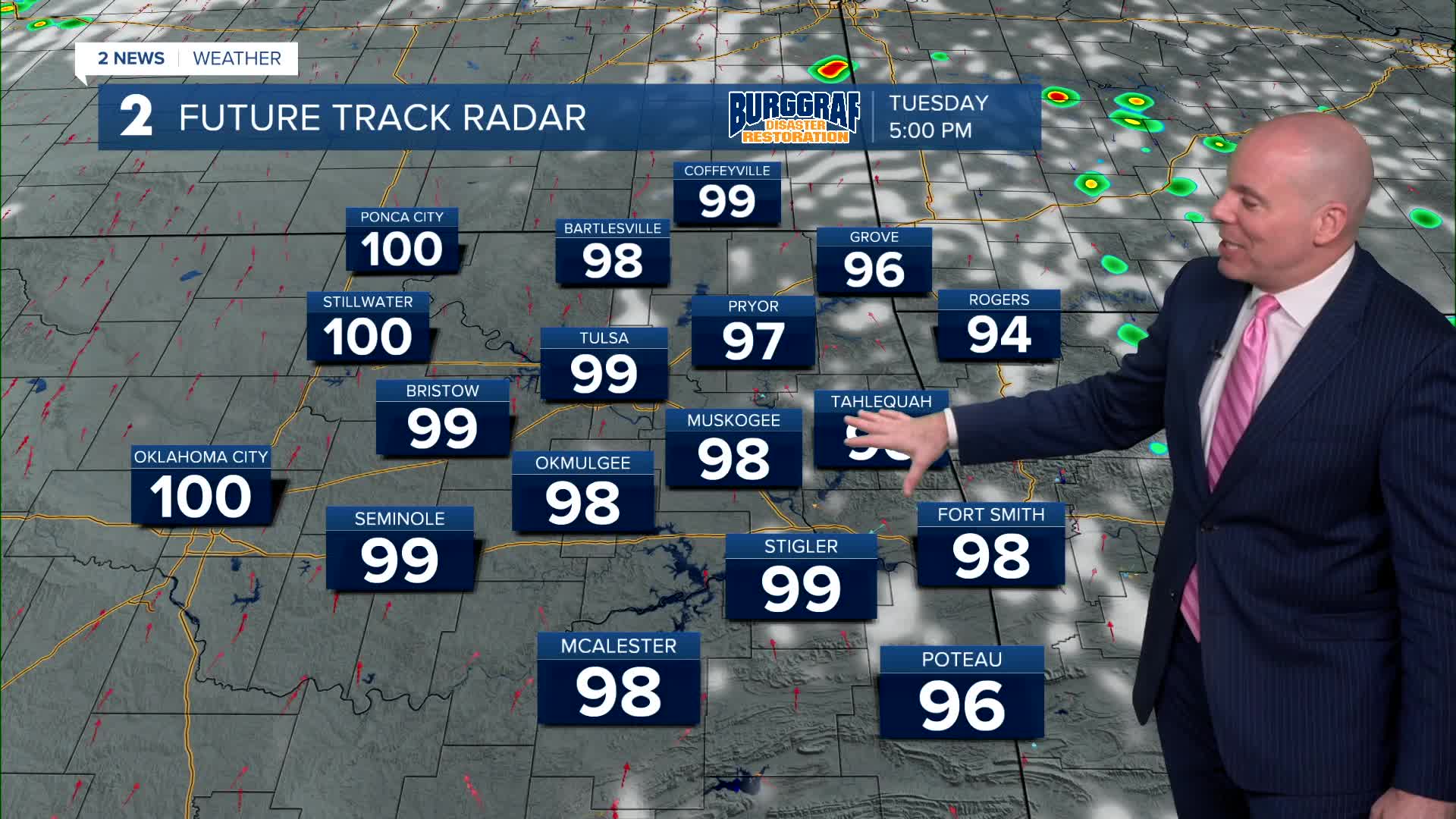
Mostly sunny Tuesday and Wednesday. Lows around 80° and then highs in the upper 90s. We should top out at 99° on Tuesday and 99° on Wednesday. Heat indices both days up to 108°.
With a front approaching the area Wednesday night, it's possible a few storms develop over northern portions of the forecast area. The front will also bring cooler temperatures to wrap up the week. A chance for a few showers and thunderstorms on Thursday. Lows in the mid 70s with highs in the low 90s. The heat index up to 99°.
Chance for a few more scattered showers and t-storms on Friday. Lows in the lower 70s and highs in the mid 80s.
Over the weekend, chance for a few more showers and t-storms on Saturday. Slim chance on Sunday, but the chance is there. Morning lows in the upper 60s to the lower 70s with highs in the mid to the upper 80s.
Finally some relief from the summer heat!
Stay in touch with us anytime, anywhere --
- Download our free app for Apple, Android and Kindle devices.
- Sign up for daily newsletters emailed to you
- Like us on Facebook
- Follow us on Instagram
- Watch LIVE 24/7 on YouTube
