

TULSA, OKLA — Winds will eventually settle down overnight with clear skies allowing overnight lows to drop into the mid/upper 20s by daybreak Friday.
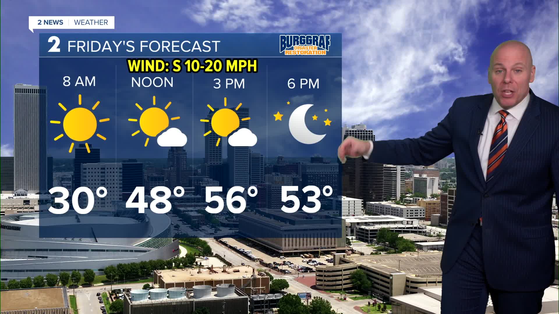
Southerly winds will return Friday allowing for a quick recovery in temperatures. Highs in the mid 50s with lots of sunshine! If you are going to Norman for the OU vs Alabama College Football Playoff game, look for temps in the low/mid 50s at kickoff with temps near 50 at the end of the game. Expect a great night for football.
On Saturday before another front sweeps though, highs will reach the low/mid 60s. Lows start out in the mid 40s. Mostly sunny. Behind the front on Sunday, look for in the 30s with daytime highs reaching the 50s. The weather will cooperate for any last minute holiday shopping plans.
Low clouds may approach from the south by the end of the day Sunday, but more so into Sunday night. Clouds will keep skies cloudy to mostly cloudy on Monday with highs near 60.
A warm stretch of weather is expected Tuesday through Friday of next week with highs well into the 70s. We will likely have a chance to break some record highs and perhaps some record warm low temperatures, including on Christmas Day. It won't feel very Christmas-like, but at least the weather will cooperate for holiday travelers.
Stay in touch with us anytime, anywhere --
- Download our free app for Apple, Android and Kindle devices.
- Sign up for daily newsletters emailed to you
- Like us on Facebook
- Follow us on Instagram
- Watch LIVE 24/7 on YouTube
